

Backpacking into the gorgeous Cirque of the Towers
As our wild places get busier and busier, backpackers are constantly seeking new destinations. While not a secret, the Cirque of the Towers in Wyoming’s Wind River Range is a favorite for those looking to escape crowds. But it’s not just the lack of people that is the attraction; it’s the pure beauty of the Wind River Range.
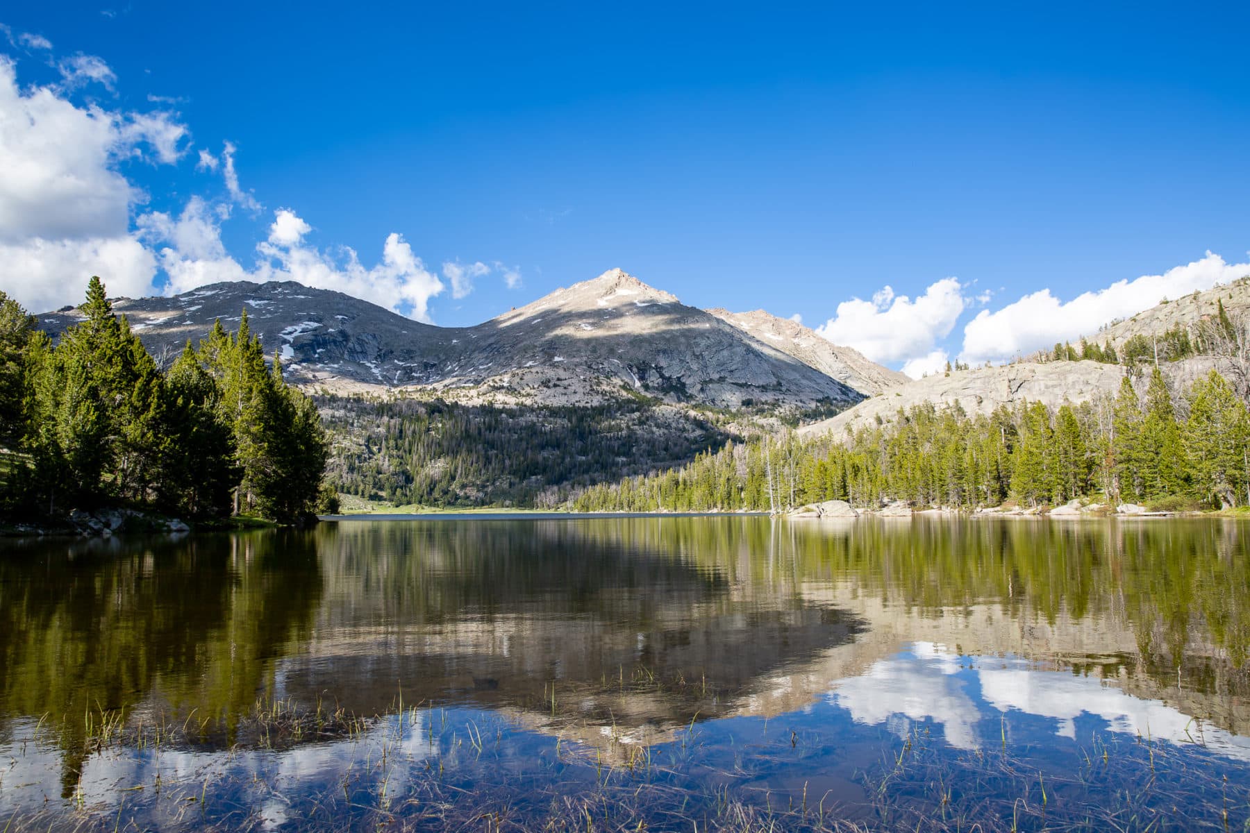
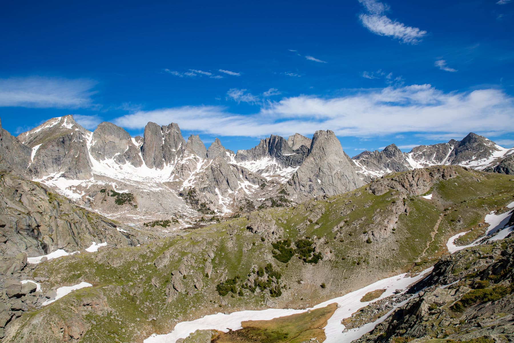
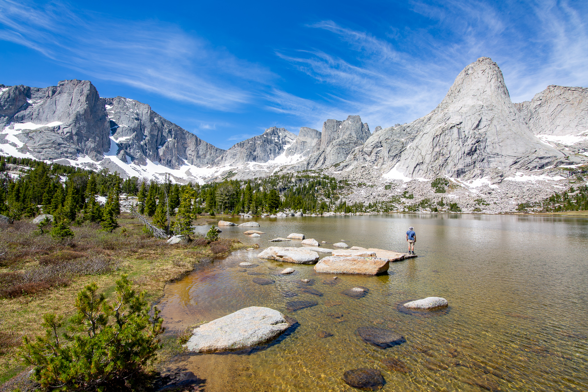
Ten miles from Big Sandy Trailhead sits Lonesome Lake. Surrounding the lake is a half-circle of towering 12,000+ foot peaks. These form the Cirque of the Towers. To this day, it is honestly one of my favorite backpacking trips and hikes I’ve ever done. The Cirque of the Towers trek offers everything an outdoorsy person wants when heading into the wild.
Below, I dive into everything you need to know for backpacking the Cirque of the Towers outside Pinedale, Wyoming.
All links are affiliate links. They cost you nothing but help support my work.
A Guide to Backpacking the Cirque of the Towers
Planning your trip to Cirque of the Towers
Where should I stay before/after backpacking the Cirque of the Towers?
It would be best to stay in Pinedale, WY, before hiking or backpacking into the Cirque of the Towers. I’ve repeatedly stayed at the Pinnacle Hotel & Suites and found them so hospitable.
You can also camp next to the trailhead at the Big Sandy Campground. This is a beautiful location, though relatively small. There are only four main sites, and it’s first come, first serve. Unfortunately, we found the road to be highly torn up around here in 2020.
Do I need a permit to backpack Wyoming’s Cirque of the Towers?
This is the beauty of the Cirque of the Towers and Wind River Range. There is no permit needed to hike or backpack here. Please treat the area respectfully, follow Leave No Trace principles, and pack out what you pack in.
What is the best time to hike the Cirque of the Towers?
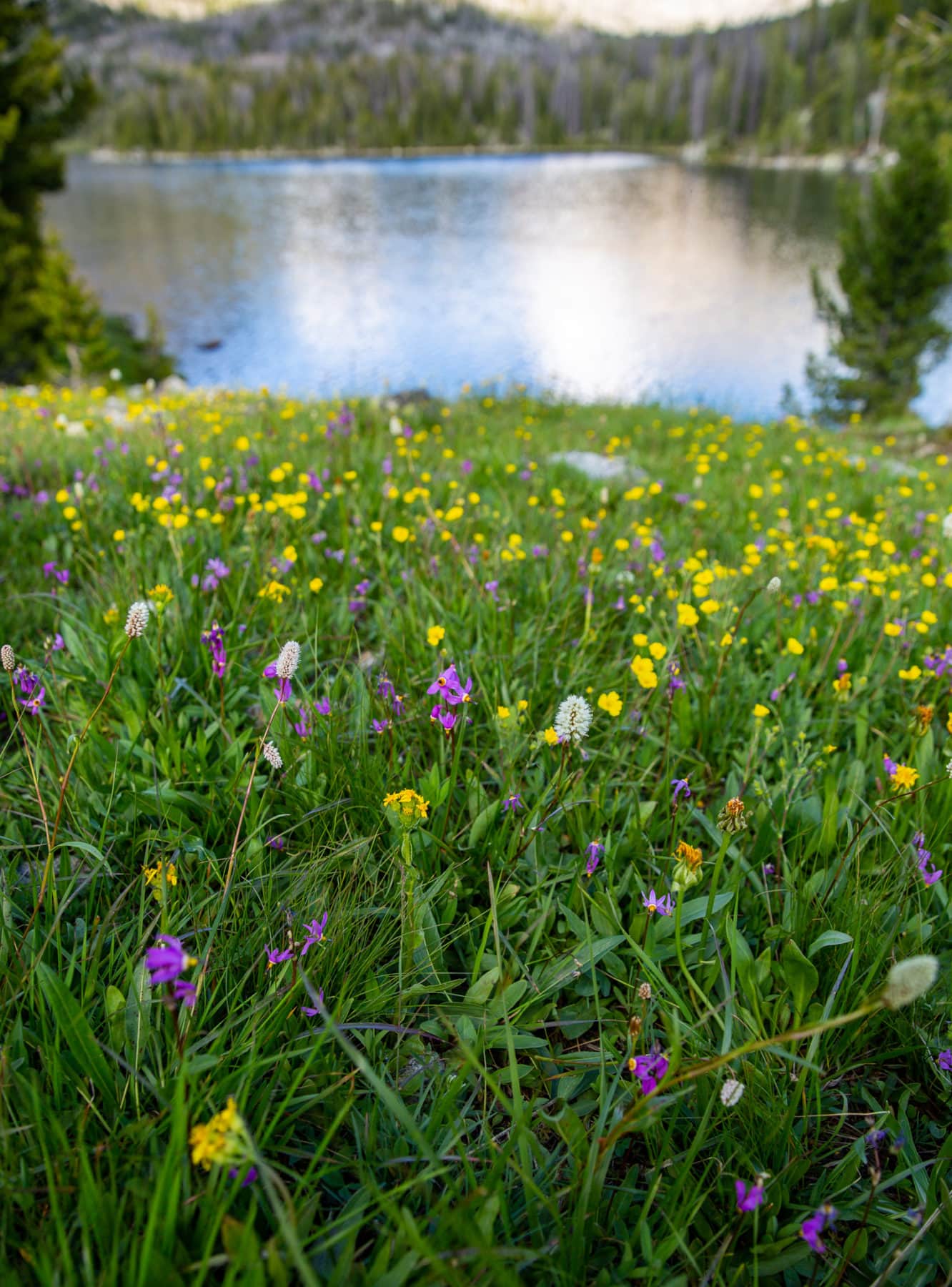
The best time to visit is June through September, depending on how heavy of a snow year. The trails should be accessible, lakes thawed out, and flowers blooming. Summer in the Cirque of the Towers is downright gorgeous!
How hard is a backpacking trip into the Wind River Range?
If you’re only doing an out-and-back day hike, it’s pretty challenging due to its nearly 20 miles. But it’s above average in difficulty if you’re backpacking the Cirque of the Towers. While the days aren’t too challenging, you’re still hiking above nine and ten thousand feet which can affect some hikers.
The Gear I Used Backpacking Cirque of the Towers
- Light backpacking tent
- 15-30 degree sleeping bag
- Light, yet comfy sleeping pad
- 55L-65L backpacking bag
- Jet Boil Stove
- Water filter
- Hiking Poles
- Backpacking Chair
- Backpacking Meals
- LOWA Boots
- 1x Hiking Pants, 1x Sunshirt, 1x Down Jacket, 1x Rain Jacket, 1x sleeping shirt, 1x leggings, 1x beanie and hat
How to get to the Cirque of the Towers
Before getting to the Big Sandy Trailhead, you have about a 90-minute* drive from Pinedale to the trailhead (*could be less if you have a high-clearance car). The road, for most of it, is suitable for compact cars, but you’ll have to do some fancy maneuvering at a couple of spots. But, overall, you’ll be fine.
Backpacking Cirque of the Towers Trail Details – Out and Back
How long is the hike to Cirque of the Towers?
Length: ~ 20 miles
Route: Out and Back or a Loop
Elevation Gain: 2,500 feet (or more if doing the loop)
Highest Point: 10,800 (out and back), 11,500 (loop)
Water accessibility: Consistently throughout
Permit Needed: None
Our backpacking route into Wyoming’s Cirque of the Towers
Big Sandy to North Lake 8 miles Day 1
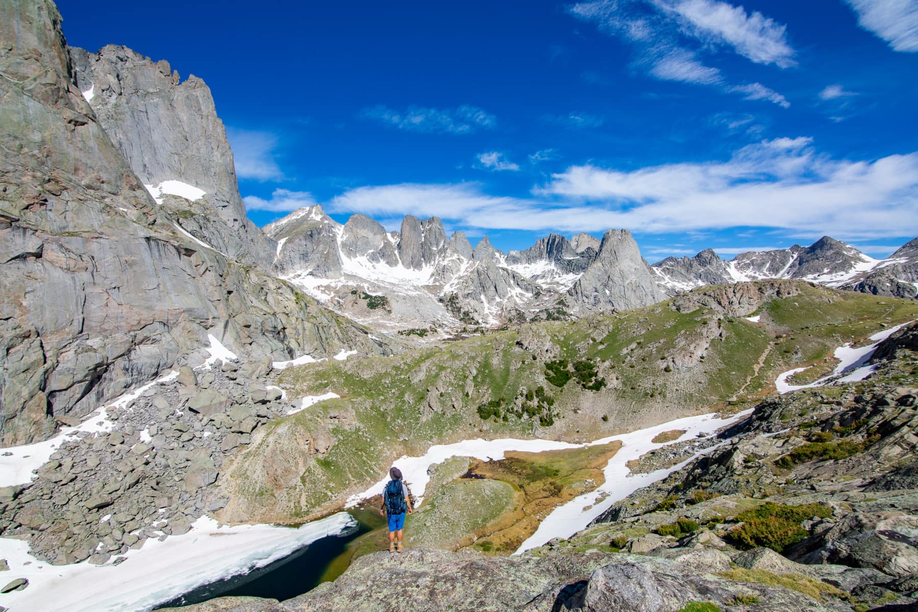
We did an out-and-back overnight on the Big Sandy Trail when I hiked into the Cirque of the Towers. This meant we passed by Big Sandy Lake, North Lake, and Arrowhead Lake before hitting Jackass Pass on our way to Lonesome Lake. It is a stunning area with flowing water all over the place, tons of lakes, and peaks that are as jagged as can be.
Overall, it’s not too challenging of a hike, as over half of it is flat or nearly flat, and the elevation gain isn’t too strenuous. However, this is a steal for how much beauty and its picturesqueness.
Getting to Big Sandy Lake is hardly more than a walk in the park. At only 6.5 miles, you gain some elevation, but it will feel minimal until the backside of Big Sandy Lake. This is where the elevation begins. If you’re not feeling super adventurous or doing the full loop, camping around Big Sandy isn’t a bad option. There are many spots, though the bugs may be worse than higher up.
Where to camp while backpacking the Cirque of the Towers
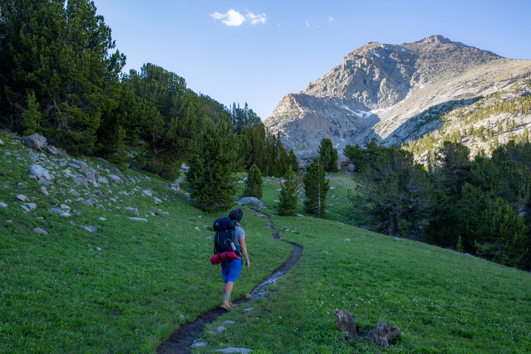
My brother and I camped above North Lake. Getting here requires your first major uphill section of the trip. It’s about 500 feet of gain in 1.5 miles – nothing overly strenuous. A small but nice grassy area on the left side of the trail past the trees offers a handful of camping options.
Trees offered both wind and people protection, which helped with the solitude. Overall, I’d say it was .15 miles off the trail. I remember at least two campaign spots, but I’m sure there are a few more.
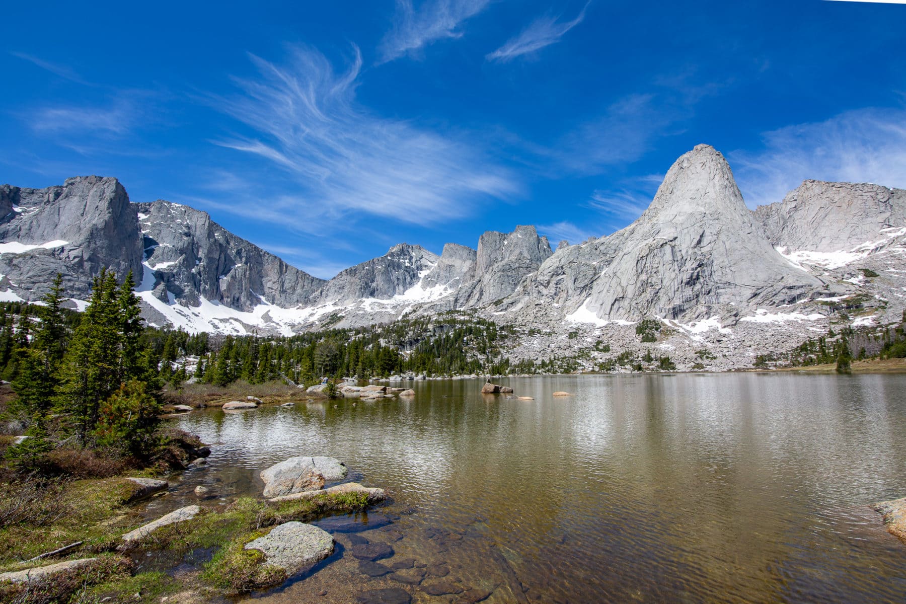
Additionally, there’s no camping allowed within a quarter-mile of Lonesome Lake, which seems fine ideally until you realize that basically takes away all options in the basin. (We didn’t go to the far side towards Texas Pass, so maybe there are options, but then again, you aren’t close to the lake.
Hikine to Lonesome Lake and then out – 10 miles Day 2
On our second day, we continued towards Lonesome Lake. The first lake you reach, Arrowhead Lake, has two routes you can take around it toward Jackass Pass.
Option 1: Continue right on Big Sandy Trail, taking you high above the lake before bringing you down and up again as you hit Jackass Pass.
Option 2: Stay left of the lake and hike amongst the rockfall area, which will require some bouldering. This can also be weather-dependent if there’s good snow/ice to walk on.
If you go early enough in the season, you can probably stay low and hike on the frozen lake. It is pretty flat along the lake, but if it melts, you’ll head over the boulders. We went high and to the right on the approach and tackled the lower shoreline on the return.
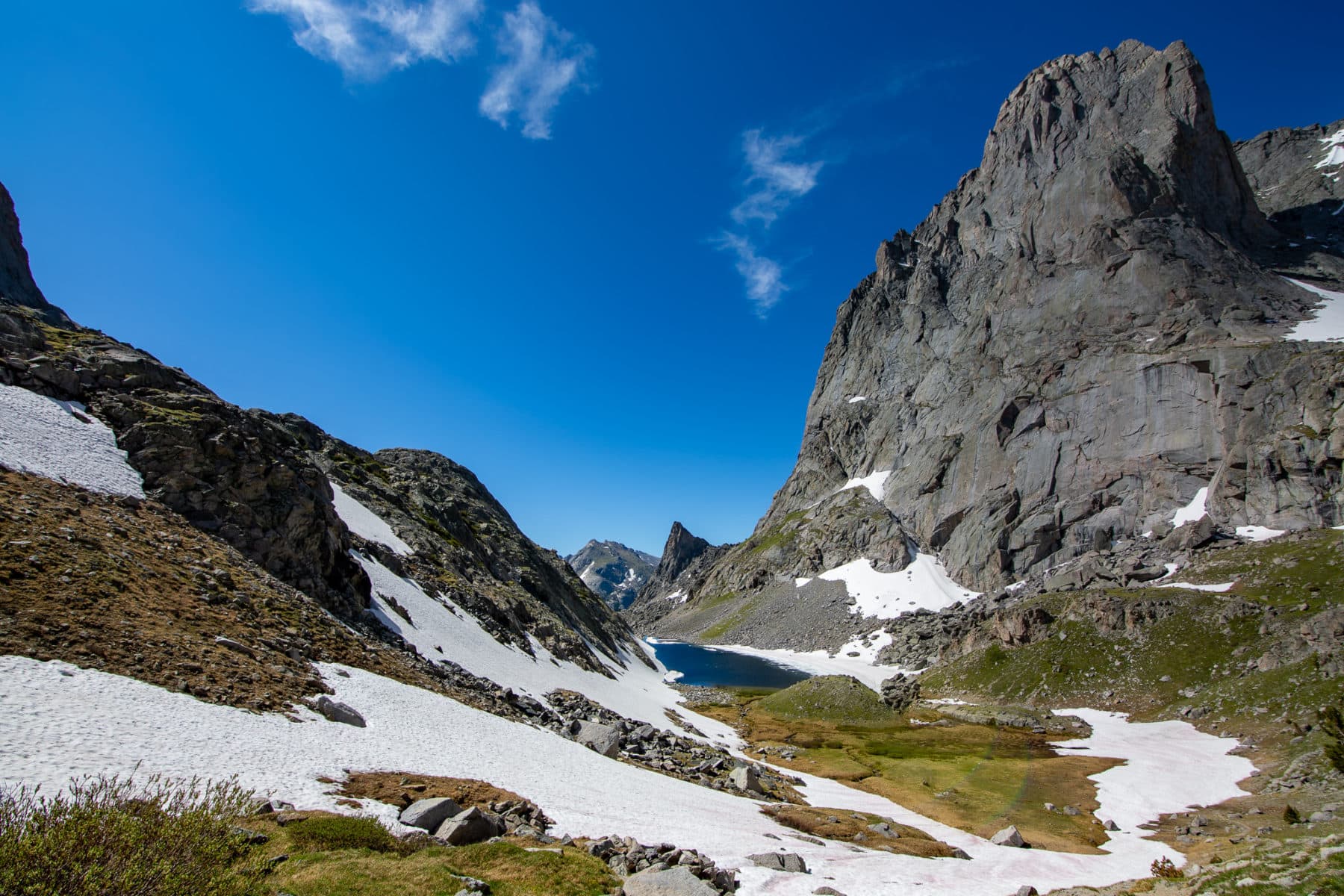
Finally, we reached Jackass Pass. It’s a perfect place to take a snack break before turning around or heading down to the lakeshore. Depending on when you hike, you may encounter some snow/lack of a trail heading down.
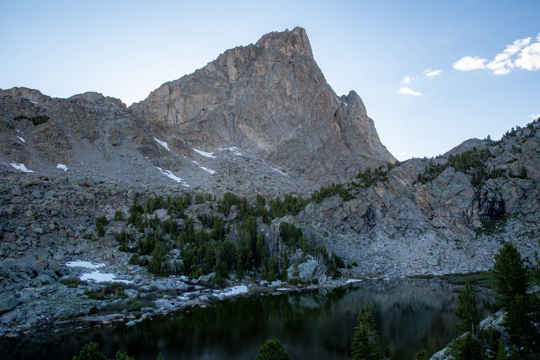
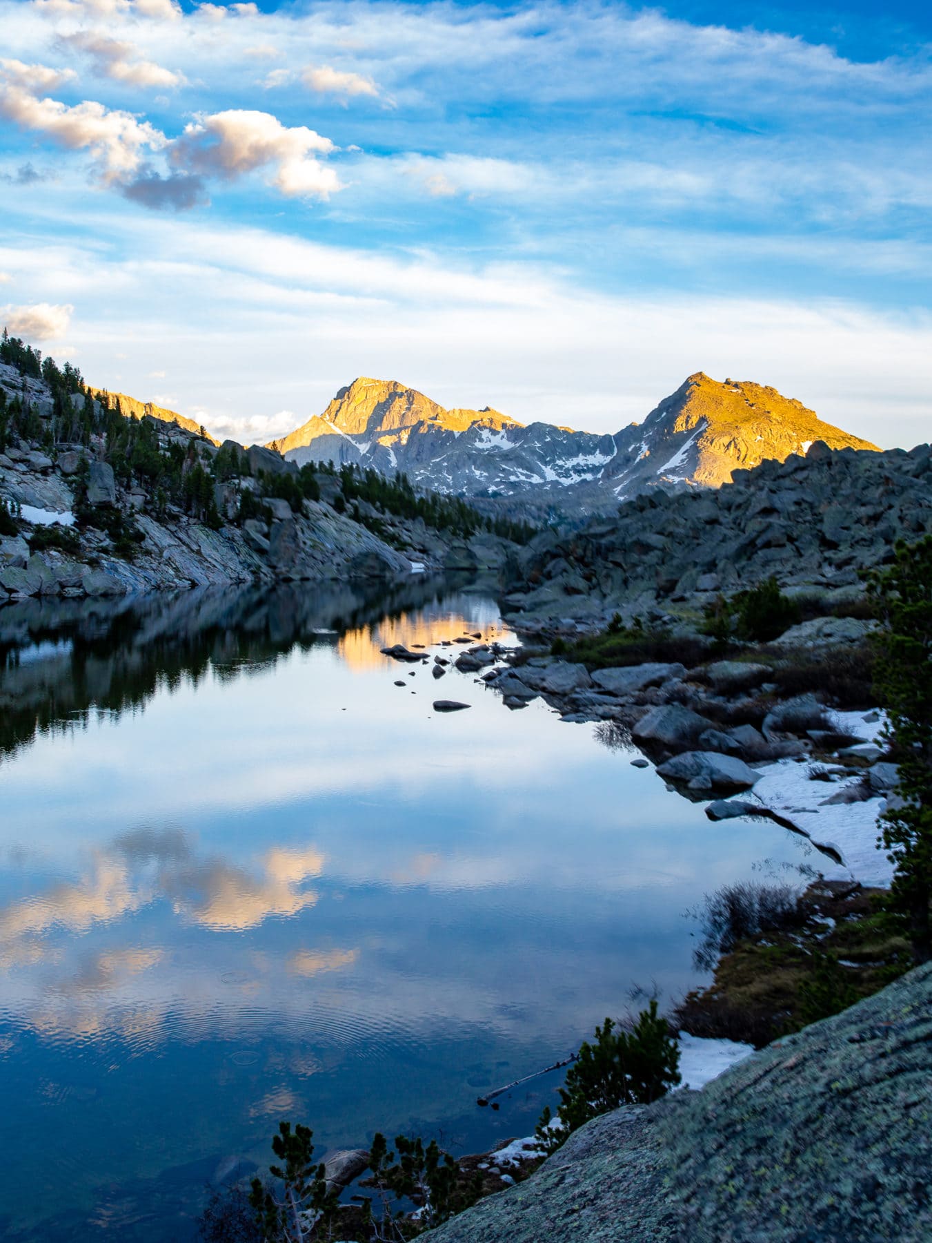
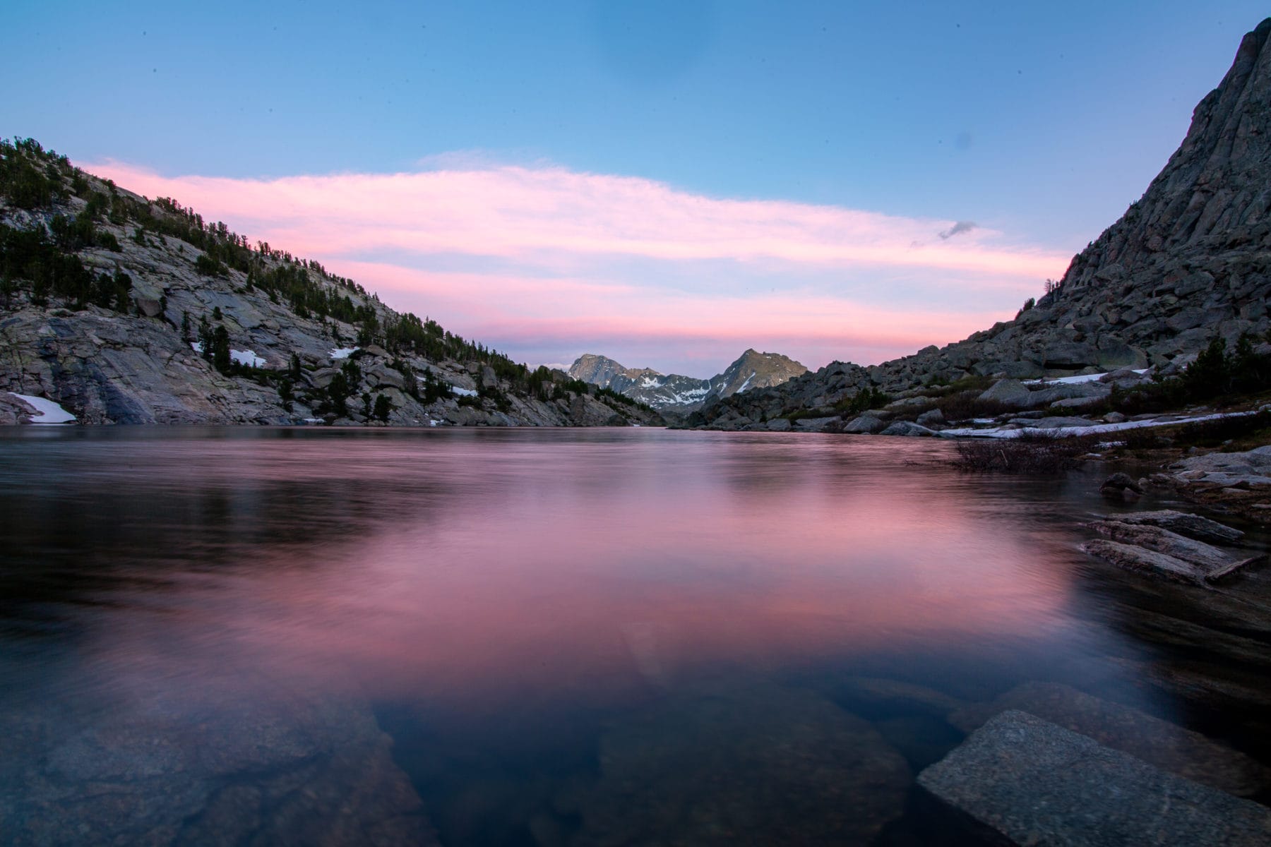
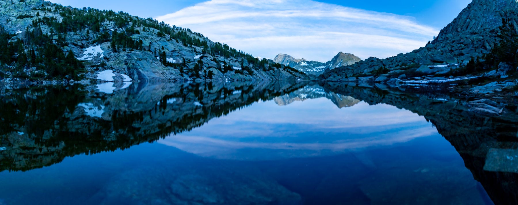
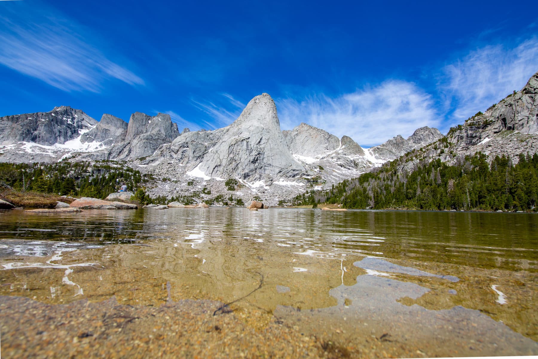
We quickly scampered down the trail to Lonesome Lake, where we took photos and wandered around. The beauty of the region was on full display here. I couldn’t believe how many striking peaks were within my eyesight.
After plenty of time at Lonesome Lake, we began our 10-mile trek to Big Sandy Trailhead. It has been a tremendous backpacking trip into the Cirque of the Towers and one I’ll never forget.
Final Thoughts/Suggestions on Backpacking the Cirque of the Towers
- While we didn’t do the Cirque of the Towers loop, I highly suggest it. Texas Pass looked too snowed in late June, but people still did it. If you have an ice axe, the proper shoe attire, and microspikes, you could quickly get up and over the pass.
- Break it up into three 7-mile days, which seems most logical. While Shadow Lake is only around the 12-mile mark, a stream/river hugs the trail if you want to keep going.
- Backpacking the Wind River Range is absolutely amazing, and this is a pretty easy route if you want to hike into the range and you’re not experienced.
- This route is getting more and more popular, but it is still one of the more remote places you can backpack without a permit.
- Don’t miss out on the brewery in Pinedale post-hike. It’s fantastic.
Wishing you all the best as you hopefully head into the Cirque of the Towers. If you’re also interested in backpacking Titcomb Basin in the Wind River Range, you can read about it here.
Until next time adventurers, take care and be safe.
Are you looking for essential camping gear? Find 10 must-haves here.
Follow my adventures on TikTok, Facebook, and Instagram.
Are you an outdoors brand or tourism board and would like to work together? Please take a look at my photography portfolio here.