
Adventure Guide for the Cape Flattery Trail in Washington
Nestled in the lush and rugged landscape of Washington’s Olympic Peninsula lies Cape Flattery, a lovely coastal area that offers hikers a unique opportunity to explore the stunning Pacific Northwest coastline. Known for its sea cliffs and vibrant forests, the Cape Flattery Trail is an excellent destination for outdoor enthusiasts seeking time away from the National Park crowds.
Inside, we’ll explore the most northwestern point in the Lower 48 and what else there is to see in this beautiful stretch of wilderness.
Exploring Around the Beautiful Cape Flattery Trail
Quick Hiking Stats
- Distance: 1.5 miles (AllTrails link)
- Difficulty: Easy
- Elevation Gain: 230 feet (down there, up on the way back
- Estimated Time on Trail: 1-2 hours
- Trailhead Location: Click here.

Trail Report for the Cape Flattery Hike
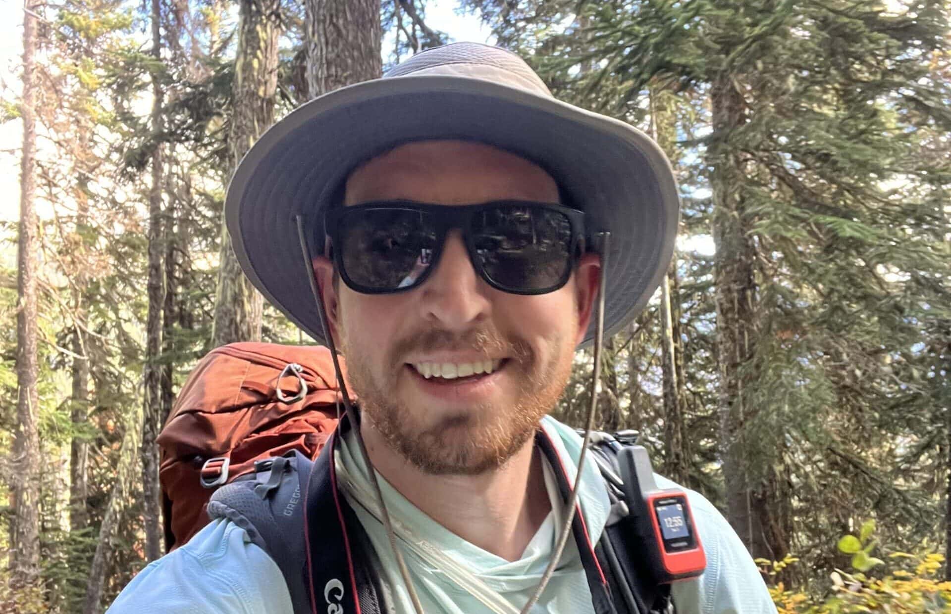
After hiking out to Shi Shi Beach earlier in the day, we headed towards Cape Flattery for our final Olympic Peninsula road trip stop. We’d spent three days exploring this brilliant area and were excited to see the northwesternmost point in the contiguous US.
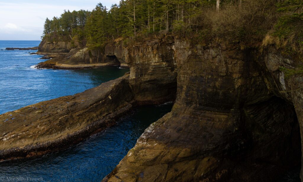
The Cape Flattery Trail is pretty short, only 1.5 miles round trip, and quite easy. From the parking lot, you descend a couple hundred feet. The first part of the trail is dirt but then transitions to a boardwalk as you get close to the various observation decks that overlook the sea and cliffs.
Over the final quarter of a mile, you can look north and south from two decks, with the last viewpoint looking west at the lighthouse and island just offshore.
I’ll be honest, though; I was a bit underwhelmed by it all. Obviously, the trail is short, so there’s only so much to see. But what really bummed me out was the views of the ocean and cliffs. I envisioned it being more dramatic than it was.
Maybe the photographer in me didn’t like the compositions or “niceness” of the photography opportunities, but I left feeling less than satisfied. But from a nature perspective, it’s a lovely place to spend an hour or two.
Overall, if you’re in the area, make sure to do the Cape Flattery Trail. But if you’re not planning to do anything else in Neah Bay, I say it’s not worth the extra two-plus hour drive.
(Side note: Exploring Hobuck Beach and Shi Shi Beach is highly worth it, so you should visit the area.)


Your Guide to Hiking to Cape Flattery in Washington
What is so special about Cape Flattery?
Cape Flattery is the northwesternmost point in the contiguous United States. This means that this is the furthest north and west point, subtracting Alaska and Hawaii. For most people, this might not matter or be that cool. I’m a bit nerdy and love these wonky geographic locations.
Where is the Cape Flattery Trail Located?
Cape Flattery is on the western edge of Washington, just outside of Neah Bay. It’s about a 4.5-hour drive from Seattle through lush forests and coastal communities. From here, you can enjoy the Cape Flattery Lighthouse and, on a clear day, see Vancouver Island across the Straight of Juan de Fuca.

Finding the Trailhead
From Neah Bay, follow signs out of town on Cape Flattery Road. You’re on the right path if you see signs for Hobuck Beach/Resort. Instead of turning left and crossing a bridge, stay on Cape Flattery Road and follow it until you hit the parking lot.
It should take around 15 minutes to drive from Neah Bay.
How Hard is the Hike to Cape Flattery?
This is a very easy and straightforward hike. Almost the entire trail is on a boardwalk, making getting lost or going off-trail nearly impossible. I did this hike just a couple of months after beating cancer and having a bone marrow transplant, so most people will cruise on this trail.
The hike descends for the trek out and then heads uphill on the way out.
When is the best time of year to visit Cape Flattery?
Spring through Fall is a gorgeous time to visit the Cape Flattery and Neah Bay area. During these months, the days are longer, temperatures are warmer, and you have less chance of rain in the forecast. Still, it is Washington, and the shoulder seasons can be wet and dreary. So, check the weather forecast before venturing out to the Olympic Peninsula.
If you visit in winter, I wouldn’t be surprised if you had the entire place to yourself. That said, it’ll likely be raining and relatively cold. So, bring your rain gear, warm clothes and hot beverages.

What gear to pack for your hike
You honestly don’t need much for this short hike. Bring a water bottle, a light jacket, and a camera, and you’ll be set. For most people, you’ll be in and out before you know it!
FAQ: Exploring Cape Flattery
How did Cape Flattery get its name?
Cape Flattery, located in Washington State at the northwesternmost point of the contiguous United States, was named by British explorer Captain James Cook on March 22, 1778.
Cook named it during his expedition to the Pacific Northwest. He chose the name “Cape Flattery” because he felt that the nearby land had flattered him into thinking it was a large island or a group of islands due to its deceptive appearance when approached from the sea.
This realization that the appearance was misleading led him to give the cape its distinctive name.
Will I have cell service?
Do not expect great cell service in this area. The Cape Flattery trail is remote, and the surrounding area is also small and not exactly bustling. While we did have service in Neah Bay, I don’t think it was 5G.
Take the time to disconnect and enjoy your time in nature!

Can I fly a drone on the Cape Flattery Trail?
No. Drones are not allowed to be flown on the Makah Reservation at Cape Flattery. Leave the drone in the car as you hike.
Are there any bathrooms?
Yes, there are bathrooms at the Cape Flattery Trail parking lot.
Are dogs allowed on the trail?
Yes, dogs are allowed on the trail if kept on a leash. Make sure to bring poop bags to clean up after your pet to keep the trail clean for future visitors.
Do I need a permit to hike on the Cape Flattery Trail?
The trail does not require a specific permit, but you need a Makah Recreation Pass while on tribal land. It costs $20 and lasts for the calendar year.

What else is there to do in the area?
This area has one of the best hikes in all of Washington! Twenty minutes down the road is the Shi Shi Beach hike. It’s between 4.5 and 8 miles long and will be one of the least crowded beaches you have ever seen.
Shi Shi Beach is epic, and I think you’ll love it!
Are there places to eat here?
We found the restaurants to be underwhelming and closed at random times, which did not align with what was online. But it’s common for small towns to live by their own rules. There is a grocery store there to stock up on food while exploring the Cape Flattery area.

Final Thoughts on the Cape Flattery Trail
Hiking out to Cape Flattery offers a unique opportunity to explore the stunning beauty of the Pacific Northwest coastline.
With its rugged cliffs, lush forests, and breathtaking ocean views, this trail provides an unforgettable experience for outdoor enthusiasts of all skill levels. Whether you are seeking a peaceful walk through nature or a challenging trek along the coast, Cape Flattery has something to offer every hiker.
So, lace up your boots and hit the trail to discover the natural wonders that await at this gem on Washington’s Olympic Peninsula.
Until next time, adventurers, take care and be safe.
Follow on social media: TikTok || Instagram || Facebook || Newsletter