
Visiting McArthur-Burney Falls State Park: A Complete Guide
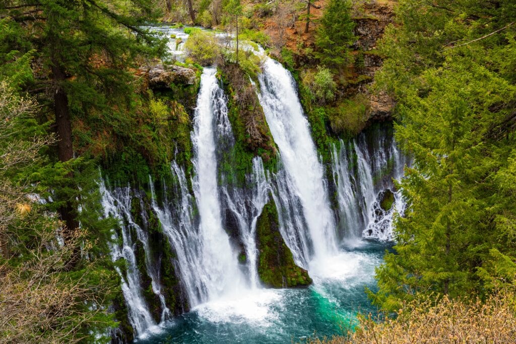
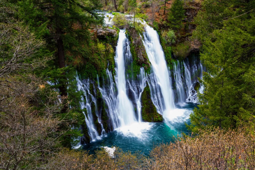
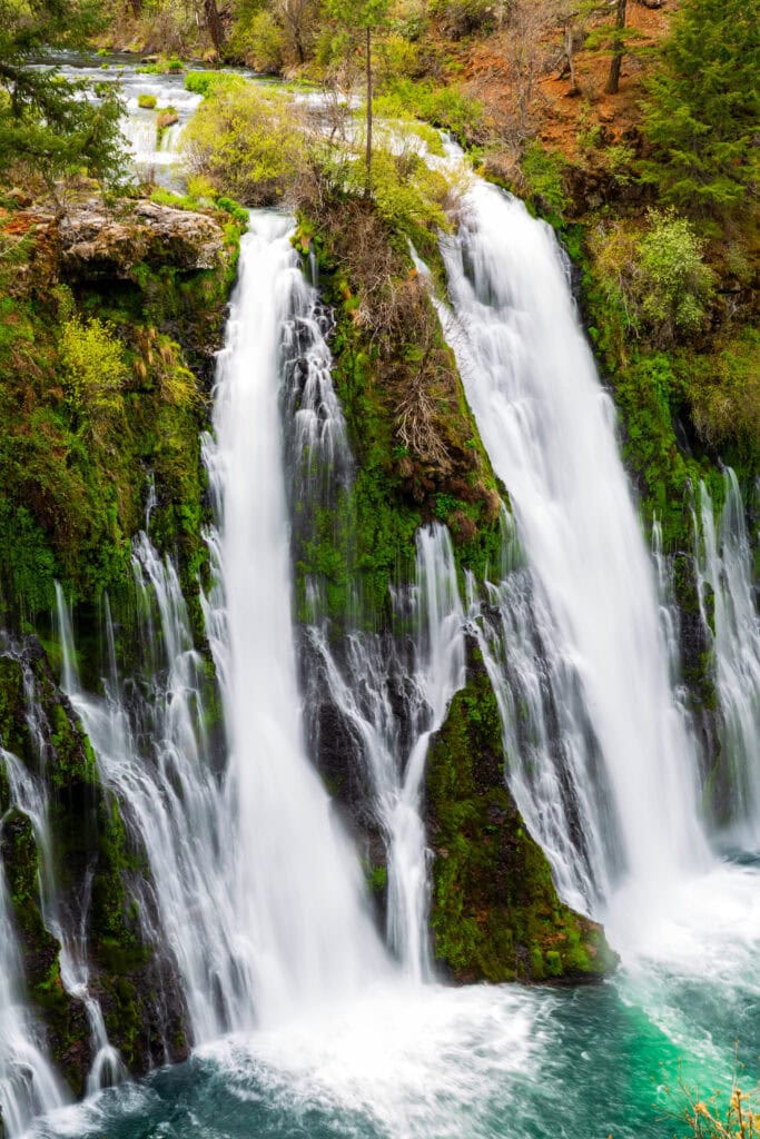
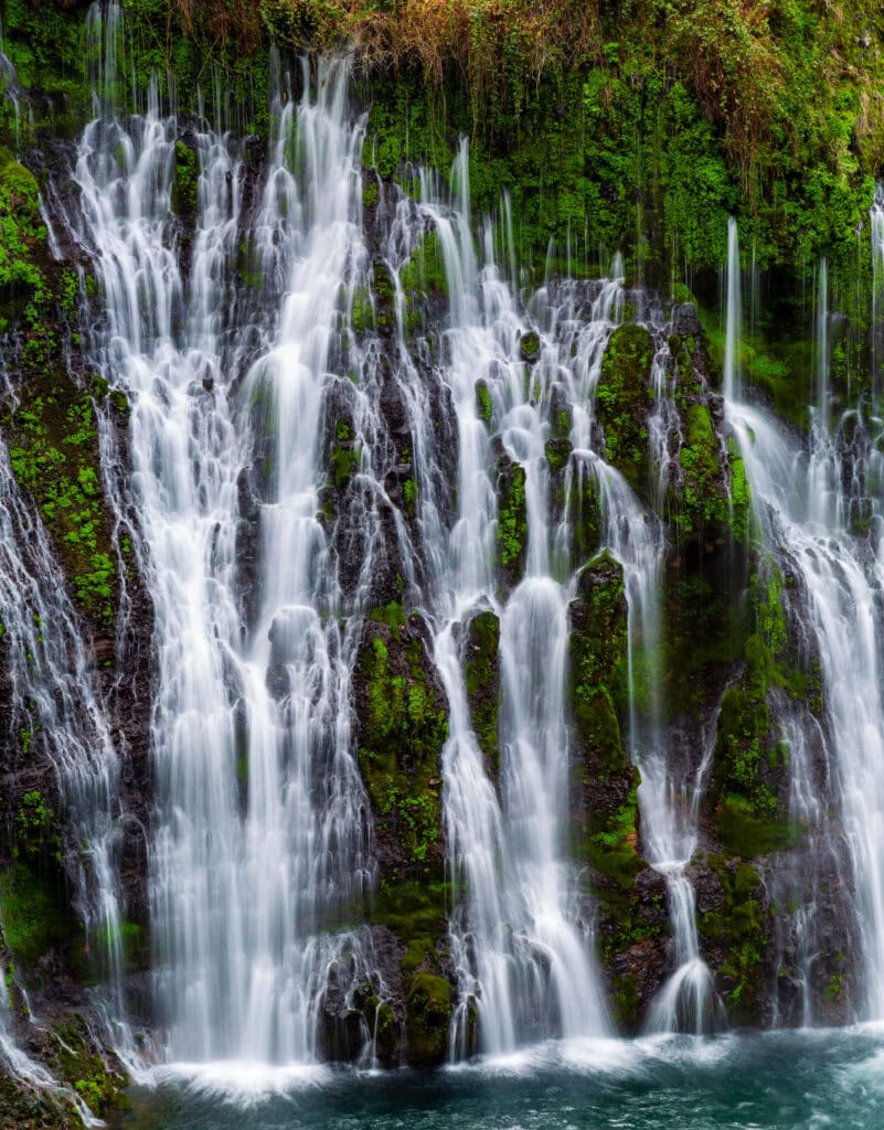
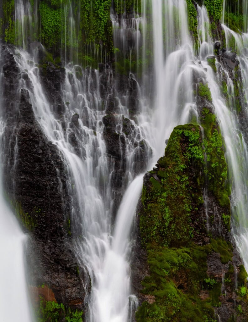
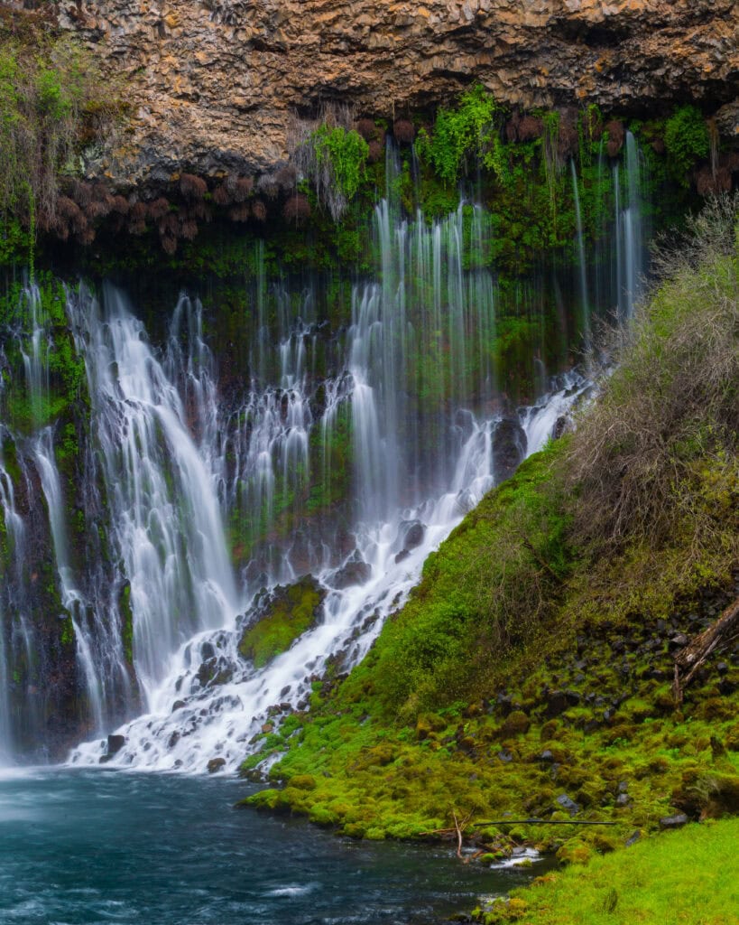
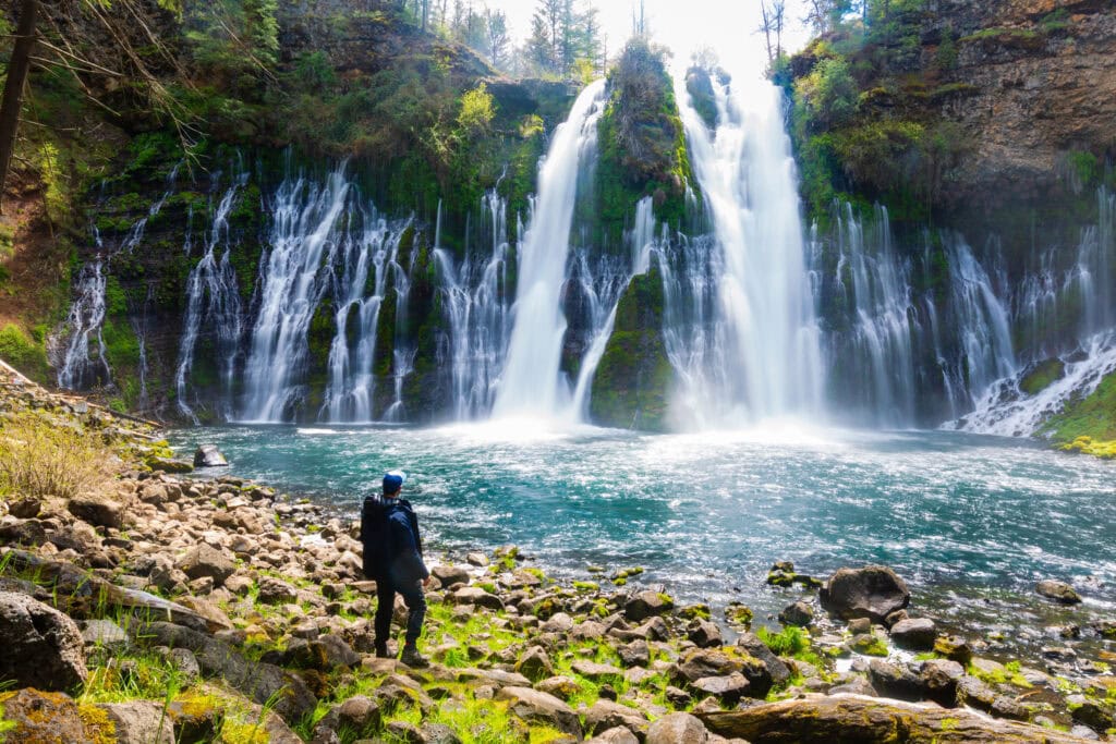
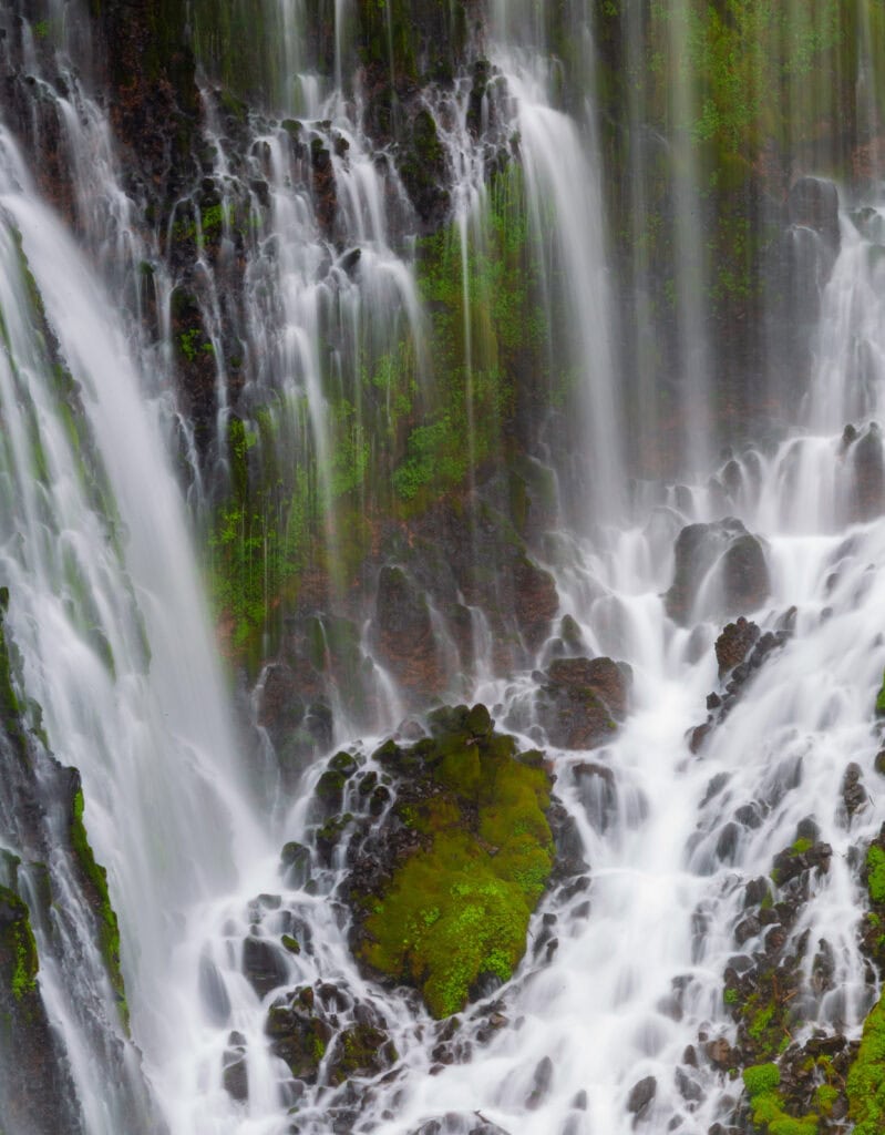
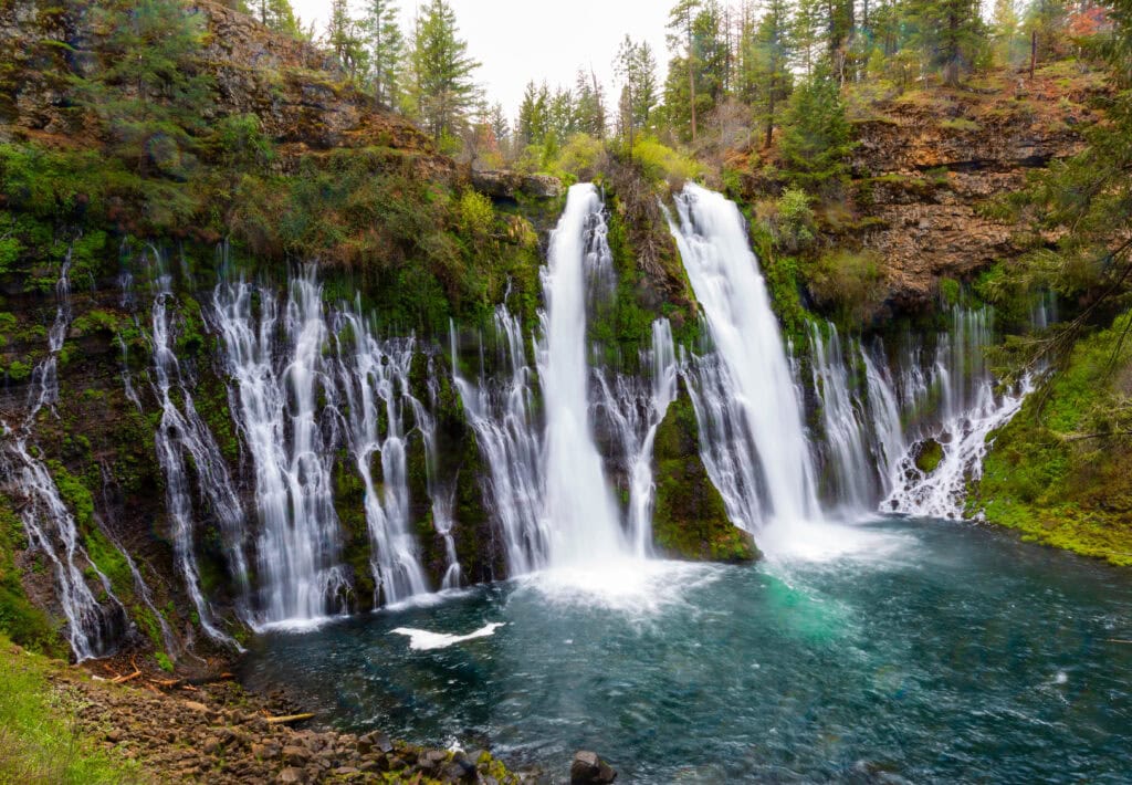
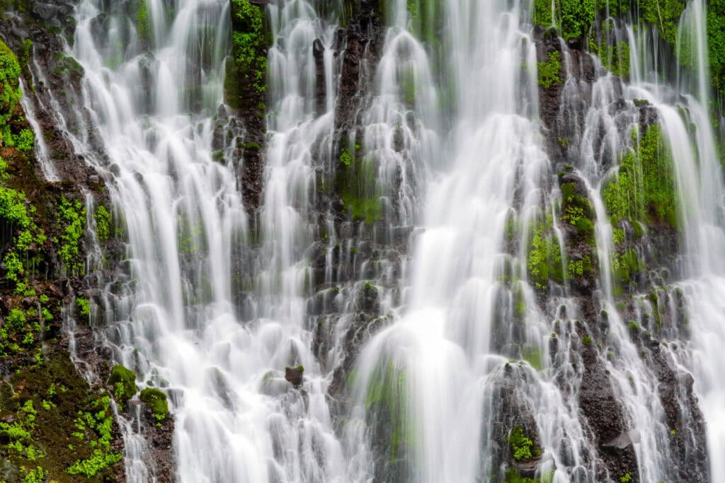
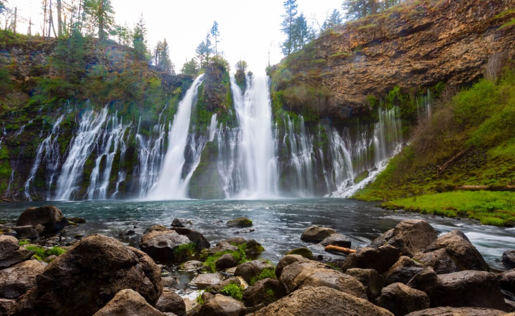
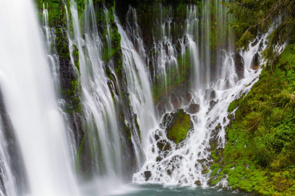
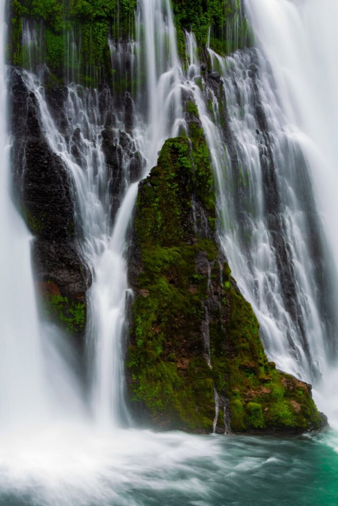
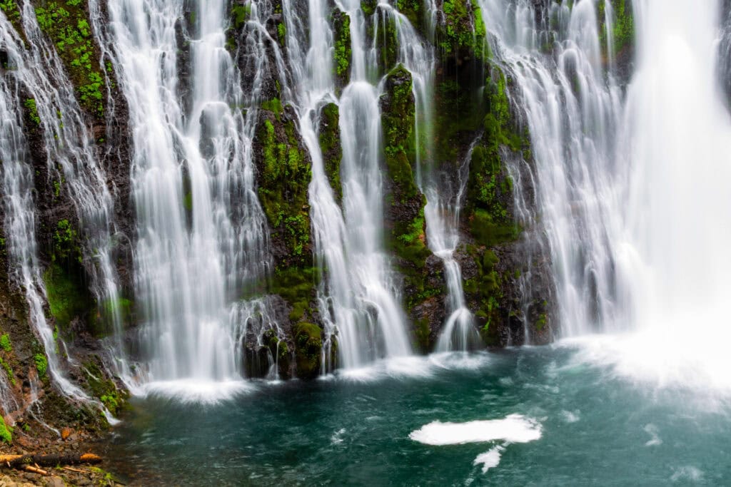
If there’s one place in the United States that reminded me of Iceland, it was my visit to McArthur-Burney Falls State Park. Its gorgeous 129-foot waterfall is one of the most beautiful views I’ve ever seen, with water flowing down in a silky, dreamlike way, from all sorts of nooks and crannies.
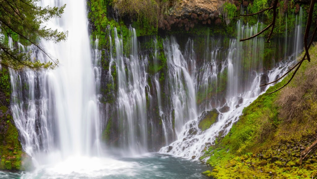
The water flows from hundreds of natural springs in the porous volcanic rock above, so the flow remains consistent year-round — roughly 100 million gallons per day — even in dry summers when California’s rivers are running low. The result is a wide, silky curtain of water that shoots from the cliff face and fills the pool below with a constant roar.
The park is also one of California’s oldest and has grown significantly in popularity over the past decade. That comes with some planning considerations you need to know before you go, especially in summer 2026. Here’s everything you need for the trip.
Do You Need a Reservation for Burney Falls?
Yes, if you’re visiting on a weekend or holiday between mid-May and late September 2026.
Starting May 15 through September 27, California State Parks launched a pilot day-use reservation program. Reservations are required on Fridays, Saturdays, Sundays, and holidays only. Monday through Thursday visits remain walk-up, first-come.
Here’s how the reservation system works:
- Book in advance through LAZ Parking on the official Burney Falls park webpage. Same-day reservations are not accepted.
- 103 morning passes are available (8 am to noon), 103 afternoon passes (1 to 5 pm), and 35 all-day passes.
- Cost is $10 per vehicle plus a $1 processing fee. Senior and disabled discounts apply.
- Annual California State Parks pass holders still need to make a reservation — just no fee applies.
- If you have an existing campsite or cabin reservation, you don’t need a separate day-use reservation.
- Day-users launching a boat also need to reserve a day-use pass in addition to the marina reservation.
If you want to skip the reservation process entirely, go on a weekday. Crowds are noticeably lighter Monday through Thursday, and you can arrive without booking ahead. Early May on a weekday is when I’d go if I could — you’ll likely have the falls mostly to yourself.
The reservation system exists because the park had been hitting capacity on summer weekends, with traffic backing up on Highway 89 for up to an hour before the entrance. Visitation has roughly doubled since 2015 as the falls became Instagram-famous, which eventually led to a full trail closure in 2024 for erosion repairs.
The trails are now back open after a nine-month rehabilitation project. The reservation system is the park’s attempt to manage it without closing anything again.
Where is McArthur-Burney Falls?
The park sits on Highway 89 in northeastern California, about six miles north of Highway 299 near the town of Burney. It’s part of the Volcanic Legacy Scenic Byway, a 500-mile route through some of the most geologically dramatic terrain in the western US.
Driving distances from common starting points:
- Redding: 75 minutes
- Lassen Volcanic National Park (north entrance): 50 minutes
- Sacramento: about 3 hours
- San Francisco: 4.5 hours
- Lake Tahoe: 3.5 hours
Cell service is limited or nonexistent in the area, depending on your carrier. Download your maps offline before leaving the highway and let people know you’ll be unreachable if you’re camping for the weekend.
Hiking Trails at McArthur-Burney Falls
The trail system is relatively small, about five miles total — but every path connects back to the falls in some way. All trails conveniently start near the visitor center.
Burney Falls Scenic Loop — 1.2 miles
This is the one most people do, and it is incredible.
The loop starts at the rim overlooking the falls, winds around through conifer forest to a bridge crossing Burney Creek upstream, then descends to the base of the falls and the pool below. It’s well-maintained throughout, family-friendly, and hits every significant viewpoint the park has to offer. If you have time for one trail, this is it.
Do the loop rather than turning around at the bottom. The perspective from the far side of the canyon is completely different from the overlook, and you’ll avoid the bottleneck of people going up and down the same path.
Headwaters Trail — 0.71 miles (out-and-back)
An accessible, mostly flat trail that heads upstream along Burney Creek from the falls overlook parking area. The creek runs clear and cold through a narrow canyon, and there’s an accessible fishing pier partway along.
Good option if you want to escape the falls crowds for a bit, or if you’re visiting with someone who can’t manage the steeper sections of the loop. The surface is compacted aggregate and rock — mostly manageable, with a couple of short sections around 10 percent grade.
Burney Creek Trail — 1.31 miles
This accessible trail connects the Lake Britton beach parking lot to a falls overlook. It’s a good option if you’re splitting your visit between the falls and the lake and want to walk between the two rather than drive.
Pacific Crest Trail Access
The park sits on the PCT, and the Fisherman’s Bridge provides access from the falls overlook parking area. If you’re section-hiking or want a longer day, the trail extends into the Trinity-Shasta National Forest in both directions. This is the main draw for backpackers passing through.
When to Visit McArthur-Burney Falls
The falls run year-round, which is part of what makes them unique. Because the flow comes from underground springs rather than snowmelt, you’re not chasing a seasonal window the way you might at Yosemite Falls or other California waterfalls. That said, timing still matters a lot for crowds and experience.
Early May (Best Overall and When I Went)
The sweet spot. Crowds are a fraction of summer levels, the park hasn’t hit its capacity yet, and the spring greenery around the falls makes for strong photos.
I was here in mid-May 2022 and got snowed on briefly on the drive in — that’s the tradeoff on the cold side, but the payoff was a nearly empty falls. If you can get here on a weekday in early May, you may have the overlook to yourself.
June through August (Busiest)
Peak season. The falls are beautiful, but so is the crowd. Weekends now require reservations, and even with the new system, expect company on the trails.
If you’re going in the summer, weekdays are dramatically better than weekends. Arrive early — the morning passes fill before the afternoon ones, and the light is better before 10 am anyway. Temperatures in the canyon can be warm and humid in July and August, so wear moisture-wicking layers and bring more water than you think you need.
September and October
The reservation requirement runs through September 27. After that, the park is open to all tourists, no matter the time of day. Fall is a solid time to visit, thanks to cooler temps, some color in the surrounding forest, and smaller crowds than peak summer. The springs keep the flow strong, so the falls look the same as in July.
Winter and Spring
The park is open, but campsite availability shifts to first-come, first-served between Labor Day and mid-May. The cabins close for winter. If you’re driving Highway 89 in late spring, be prepared for cold and possible snow above 3,000 feet, even into May. I recommend carrying chains just in case.
Photography Tips
The falls are best in the morning before the midday sun hits the canyon directly. A tripod is essential if you want silky water on a long exposure. If you’re shooting during the day, bring a 6-stop ND filter — without it, you’ll be at ISO 100 and f/16 just to keep your shutter speed in a usable range, and you’ll still struggle.
At peak flow, expect significant mist at the base. Bring a microfiber cloth for your lens and consider a rain sleeve for the camera body if you’re going to spend time down there. The rocks around the pool get slick fast.
The overlook at the top of the falls offers a wide composition of the full 129-foot drop. The canyon floor gives you a completely different shot — looking up at the falls from below, with the walls framing the water on both sides. Both are worth doing.
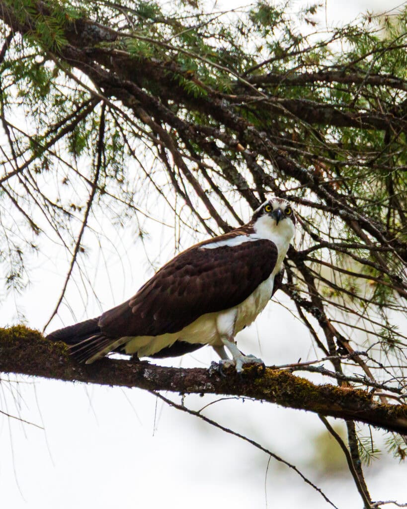
Keep your eyes on the cliff face and the trees above the falls. Hawks and eagles regularly use the thermals above the canyon, and the volcanic rock on either side often has smaller birds using the crevices.
Lake Britton
Lake Britton is within the park boundary and is worth adding to your visit if you’re spending a full day or camping. It’s a separate drive from the falls parking area, so most day visitors skip it, making it considerably less crowded.
The lake has a swim beach and a boat launch. The concessionaire operates a marina with cabin rentals and the Burney Falls General Store. Fishing is good along the lake and in Burney Creek, with rainbow, brook, and brown trout in the water. If you’re launching a boat on a weekend during peak season, note that you’ll need both a marina reservation and a separate day-use vehicle reservation.
The Burney Creek Trail connects the lake parking area to the falls overlook if you want to walk between the two. It’s 1.31 miles of accessible trail — manageable if you’re already in walking mode.
Camping at McArthur-Burney Falls
The park has 102 campsites across the Rim and Pioneer campgrounds, plus a small number of cabins. Reservations open six months in advance through ReserveCalifornia and go quickly on summer weekends — if you want a July or August date, set a reminder and book the moment the window opens.
Nightly camping rates are $35 for one vehicle, plus $10 for a second vehicle. The cabins are closed during winter. Between Labor Day and mid-May, campsites operate on a first-come, first-served basis.
If the park is full, Dusty Campground on the north shore of Lake Britton is about 13 miles away. It has six primitive sites on a first-come, first-served basis with picnic tables, bathrooms, and coin-operated showers.
The park sells firewood bundles near the entrance — cash only. Buy local rather than bringing wood from home; this matters because out-of-area wood can carry diseases and pests that damage the native forest.
A note on dogs: they’re welcome in the campground and throughout the park, but they’re not allowed on any trails except the Pioneer Cemetery Trail. Plan accordingly if you’re bringing a dog on a day visit.
Parking and Crowds: What to Expect
This is the section I wish I’d had before my first visit. The park is small, the parking lot fills fast, and the area around Highway 89 has some specific rules that catch people off guard.
Key things to know:
- Parking along Highway 89 is illegal for one mile in either direction of the park entrance. Vehicles parked on the highway shoulder will be cited and towed — not warned.
- The park fills up on most summer weekends. When it’s full, the entrance closes temporarily. The typical pattern is to check back after 4 pm, when some day visitors start to leave.
- The speed limit on Highway 89 is 55 mph, and it carries significant truck traffic. Walking along the highway shoulder to reach the park from an illegal parking spot is dangerous, not just a rules issue.
- If you’re visiting on a weekend between May 15 and September 27, you need an advance day-use reservation. Without one, you may drive an hour or more only to be turned away at the entrance.
The easiest solution to all of this: go on a weekday, arrive before 9 am, and book a reservation if you’re going on a weekend. The park is spectacular and worth the planning — don’t wing it on a Saturday in July.
Where to Stay Near McArthur-Burney Falls
If you’re not camping in the park, the town of Burney is about 10 miles away and has the full range of practical options — a handful of motels, restaurants, a grocery store, and a gas station. It’s a small town, but it has everything you need for a base camp.
For a more outdoorsy option, Dusty Campground on Lake Britton’s north shore sits about 13 miles from the park. Six sites, first-come, first-served, basic facilities. Good for minimalists or anyone who doesn’t want to deal with the ReserveCalifornia system.
A Few Things to Know Before You Go
- Summer afternoons can be warm and humid in the canyon. Moisture-wicking layers, sunscreen, and extra water make the difference.
- No cell service in the park for most carriers. Download offline maps and have your trailhead plan set before you leave cell range.
- The entrance fee is $10 per vehicle, which also serves as your day-use fee (or $10 plus $1 processing fee for advance weekend reservations).
- Dogs are allowed in campgrounds but not on trails except the cemetery trail.
- The falls overlook is wheelchair- and walker-accessible, though the path down to the canyon floor has a moderate grade.
- Mist at the base of the falls can be significant during high flow. Bring a lens cloth if you’re shooting.
Frequently Asked Questions
Yes, if you’re visiting on a Friday, Saturday, Sunday, or holiday between May 15 and September 27, 2026. Reservations must be made in advance through LAZ Parking on the official Burney Falls park webpage. Same-day reservations are not available. Monday through Thursday visits don’t require reservations.
Yes. The park is open year-round. Trail access was temporarily closed in 2024 for erosion rehabilitation but reopened in December 2024. All trails are currently open. The reservation system only applies from May 15 through September 27.
The Burney Falls Scenic Loop takes about one to two hours at an easy pace. If you’re adding Lake Britton, fishing, or a longer hike, plan for a half-day or full-day. Photographers often spend longer — the light changes significantly through the morning.
Swimming is not permitted at the falls pool. Lake Britton, inside the park, has a swim beach and is the place to get in the water.
Dogs are welcome in the park and at the campground, but are not allowed on any trails except the Pioneer Cemetery Trail.
About 75 minutes east of Redding via Highway 299 and then Highway 89 north.
About 50 minutes from the north entrance to Lassen. The two parks pair well as a weekend or multi-day road trip.
Final Thoughts on McArthur Burney Falls State Park
This place is one of the better-kept secrets in California, though that’s changing fast. The new reservation system on peak days is a real improvement — it means the people who do show up actually get to experience the falls rather than sitting in a parking queue on Highway 89.
Go on a weekday if you can. Get there early. Walk the full loop, not just the overlook. And if you’re a photographer, bring the tripod — the mist and the spring-fed flow make for long-exposure conditions that are hard to replicate anywhere else.
If you’re building a Northern California itinerary, Burney Falls pairs naturally with Lassen Volcanic National Park to the south and Castle Crags State Park to the west. There’s a full week of outdoor photography in this corner of the state if you know where to look.
Until next time, adventurers, stay safe.
Follow on social media: TikTok || Instagram || Facebook || Newsletter | YouTube