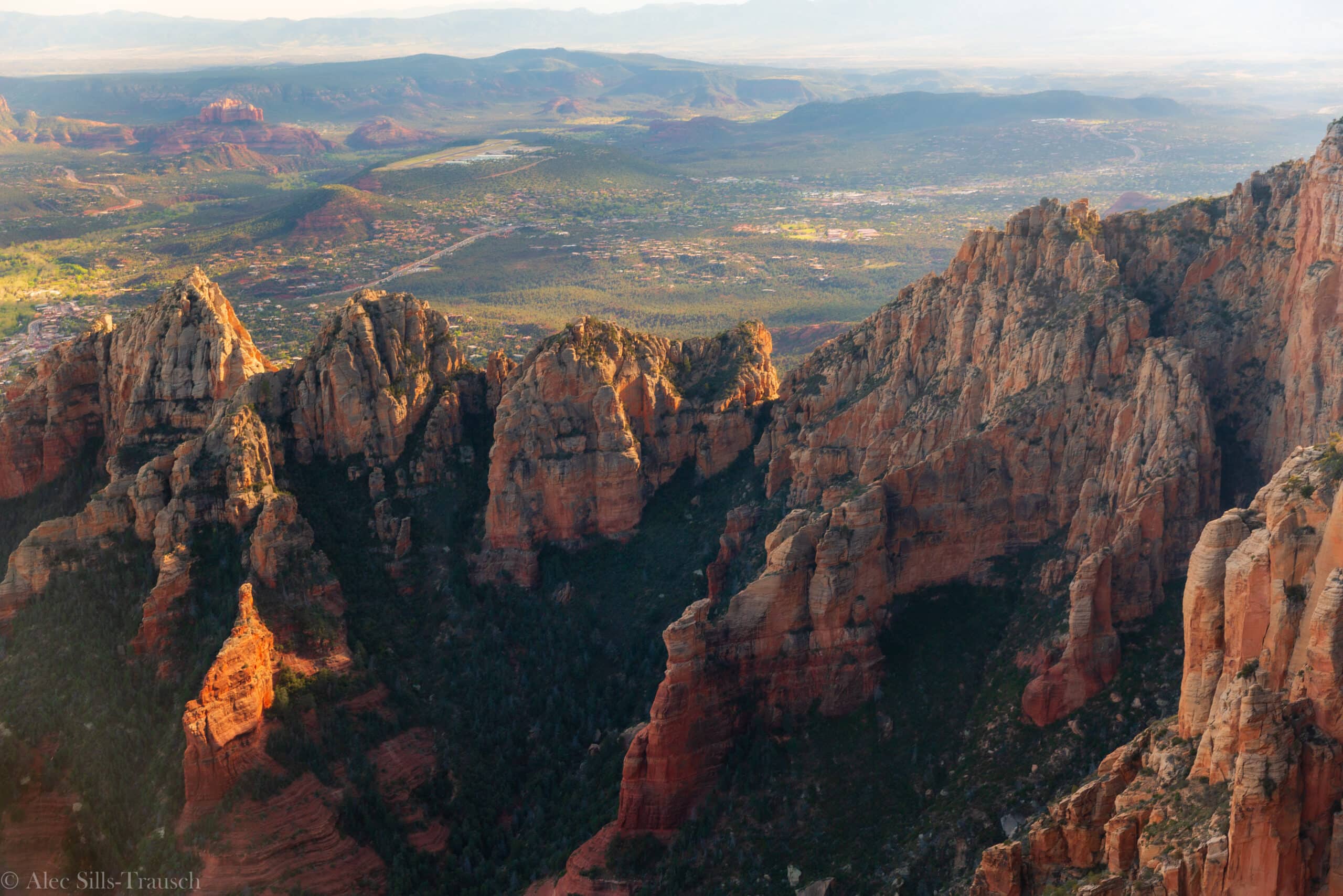
The 16 Best Hikes in Sedona, Arizona
Few places in the world offer more scenic hikes than Sedona. The red rocks, sunny days, and gorgeous landscapes make this central Arizona destination perfect almost year-round.
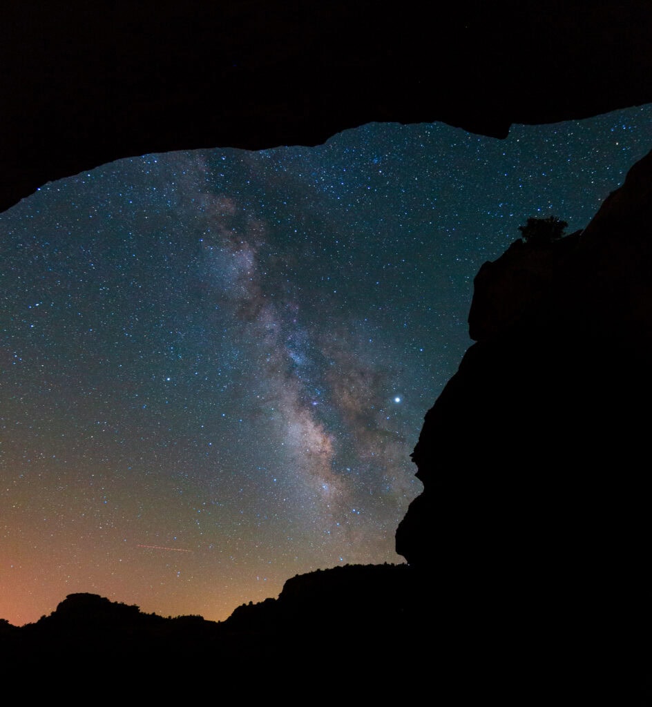
I lived in Phoenix for 28 years, and Red Rock Country was my escape. I shot the Milky Way from inside the Birthing Cave, backpacked Wilson Mountain with my dad to celebrate beating cancer in 2019, and spent countless hours tackling the best hikes in Sedona.
This guide pulls together all of this experience to help inspire you to get outside and create memories while hiking in Sedona.
Trail status update, November 2026
The Pocket Fire burned 27,393 acres north of Sedona this summer, and a Nov. 1 flood tore up State Route 89A in Oak Creek Canyon. The West Fork Trail is closed through at least Feb. 27, 2027, and 89A remains closed between Slide Rock State Park and the Oak Creek Vista overlook. Crescent Moon Picnic Site is also closed.
Apart from West Fork (#16), none of the hikes below appeared on the Forest Service closure list when I updated this guide. Conditions after floods change quickly, so check the Coconino National Forest alerts page before you go.

You’ll Love These Best Hikes in Sedona
| Hike | Round trip | Gain | Difficulty | |
| 1 | Soldier Pass | 1.3 to 4.5 mi | ~600 ft | Easy to moderate |
| 2 | Bear Mountain | 4.5 to 5.3 mi | ~2,000 ft | Hard |
| 3 | Wilson Mountain | ~8.5 mi | 2,400 to 2,850 ft | Hard |
| 4 | Cathedral Rock | 1.1 mi | ~670 ft | Moderate, steep scrambles |
| 5 | Devil’s Bridge | 2 to 4.6 mi | ~400 to 500 ft | Moderate |
| 6 | Boynton Canyon + Subway Cave | 5 to 6 mi | ~930 ft | Moderate |
| 7 | Hangover Trail loop | 6 to 9 mi | ~900 to 1,200 ft | Moderate to Hard |
| 8 | Doe Mountain | 1.5 to 3 mi | ~450 to 550 ft | Easy to moderate |
| 9 | Secret Slickrock | ~1 mi | <100 ft | Easy |
| 10 | Birthing Cave | 2 mi | ~250 ft | Easy |
| 11 | Keyhole Cave | ~2.2 mi | ~500 ft | Moderate, scramble |
| 12 | Brins Mesa | 5.5 to 7 mi | ~650 to 900 ft | Moderate |
| 13 | Fay Canyon | ~2.4 mi | ~200 ft | Easy |
| 14 | Airport Loop | 3.3 to 3.5 mi | ~340 to 535 ft | Moderate |
| 15 | Bell Rock + Courthouse Butte | ~3.8 mi | ~300 ft | Easy to moderate |
| 16 | West Fork of Oak Creek (closed into 2027) | ~6.6 mi | ~250 ft | Easy to moderate |
1. Soldier Pass Trail
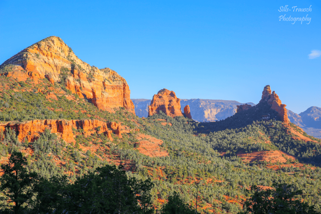
Soldier Pass is a short hike crowded with geologic oddities. A quarter mile from the trailhead, you reach Devil’s Kitchen, a collapsed pit with sheer red walls and no guardrails. Less than half a mile later, the Seven Sacred Pools appear on your left: a staircase of sandstone basins that hold water after rain.
Keep going about 0.6 miles past the pools and watch for a fork, where the busier path on the right climbs to Soldier Pass Cave. I bungled that turn on my first visit. Inside, afternoon light slants through the openings and turns the chamber amber.
Easy Booking: Expedia.com | Hotels.com | VRBO | Booking.com | Airbnb.com
Need Gear: Find Gear at REI
Find Awesome Tours: Viator.com or GetYourGuide.com
First time here? Stay in touch by following on IG: @Alecoutside and my newsletter
Purchase my 2027 Scenic Calendar
Please stay safe out there and follow Leave No Trace principles as best you can.
Soldier Pass trail details
- Distance: About 1.3 miles round trip to the pools; 4 to 4.5 miles round trip to the cave and arches
- Elevation gain: Roughly 600 feet for the full hike
- Difficulty: Easy to the pools, moderate to the cave
- Trailhead: Soldier Pass Trailhead at the end of Forest Road 9904 in West Sedona
- Parking: Gated 14-space lot open 8 a.m. to 6 p.m., closed to private cars when the shuttle runs. Ride the shuttle from the West 89A Park & Ride instead.
More caves to seek out: my guide to the best Sedona caves
2. Bear Mountain

One of the best hikes in Sedona by far. Bear Mountain sits on the far west edge of Red Rock Country, and that distance, plus its difficulty, thins the crowds.
The trail crosses a flat stretch of desert, then starts climbing ledges of red and cream sandstone. It gains close to 1,000 feet per mile, and the last mile felt steeper to me than everything below it.
The reward is a stunning view across Sedona from an angle few visitors see. The cacti were blooming on my June hike, and on my last trip up in 2019, I didn’t see another person. My watch logged 5.3 miles with about two hours of moving time and three hours total on the trail. The wilderness boundary begins just past the parking lot, so leave the drone in the car.
Bear Mountain trail details
- Distance: 4.5 miles round trip per AllTrails (my Garmin read 5.3)
- Elevation gain: About 2,000 feet
- Difficulty: Hard
- Trailhead: Bear Mountain Trailhead on Boynton Pass Road, about 15 minutes from West Sedona (shared with Doe Mountain)
- Parking: Red Rock Pass required; pit toilet at the trailhead
Full trail report: Hiking the Bear Mountain Trail
3. Wilson Mountain

Wilson Mountain rises to about 7,100 feet, taller than anything else around Sedona, and from the overlook you peer down on town with red cliffs in front of you and pale sandstone below. The first mile from Midgley Bridge climbs gradually. Switchbacks take over for the next two miles up to a broad saddle, and the last mile to the Sedona overlook eases off.
I backpacked it with my dad, and the sunset from the overlook justified hauling 40 pounds uphill. The mountain has no water and the trail bakes in summer, so save this one for the cooler months and carry plenty to drink. Parking at Midgley Bridge is tight.
In 2019, we parked in town and took a rideshare to the trailhead, which worked well. (Though many years later, this might be an option.) If you want to camp up top, check current Forest Service camping restrictions first and understand there’s no water.
The trail closed during the summer 2026 Pocket Fire and has since reopened. The alternate North Wilson route starts at Encinoso Picnic Site, which was closed after the November 2026 flood.
Wilson Mountain trail details
- Distance: About 8.5 miles round trip to the Sedona overlook; up to 11.5 miles if you roam the plateau
- Elevation gain: 2,400 to 2,850 feet
- Difficulty: Hard
- Trailhead: Midgley Bridge on SR 89A, about 2 miles north of Uptown Sedona
- Parking: Small lot; Red Rock Pass required
Full trip report: Hiking and backpacking Wilson Mountain
4. Cathedral Rock

Cathedral Rock is short and steep. The hike is 1.1 miles round trip with about 670 feet of climbing, much of it on slickrock where you will use your hands. Plan on roughly 35-45 minutes to reach the saddle between the spires, a spot many visitors know as a vortex.
I prefer sunrise here. Fewer people make the climb, and early light pours into the notch between the spires. Light pollution is low, which makes it a strong spot for night photography too. Parking is the hitch: the Back O’ Beyond Road lot closes to private cars whenever the shuttle runs, so either ride the shuttle from the North SR 179 Park & Ride or arrive outside shuttle hours.
Cathedral Rock trail details
- Distance: 1.1 miles round trip
- Elevation gain: About 670 feet
- Difficulty: Moderate, with steep slickrock scrambles
- Trailhead: Cathedral Rock Trailhead on Back O’ Beyond Road off SR 179
- Parking: Red Rock Pass required; lot closed to private cars during shuttle hours. Crescent Moon Picnic Site, the usual backup, was closed after the November 2026 flood.
Timing ideas: my favorite sunset hikes in Sedona
5. Devil’s Bridge

Devil’s Bridge is the sandstone arch that fills Sedona’s Instagram feeds. The approach stays mellow until the last half mile, where rock steps climb to the span. A Forest Service sign warns that sandstone arches are inherently unstable, so walking out onto it is your call. I will admit it felt a bit underwhelming in person compared to the photos, though it is still a fun walk.
How long the hike runs depends on where you park. Most people start at the paved Dry Creek Vista lot or the Mescal Trailhead and walk on the dirt road or the Chuck Wagon Trail. High-clearance vehicles can drive the rough stretch of Forest Road 152 to the upper Devil’s Bridge lot, which cuts the hike to about 2 miles. Weekday mornings or evenings after the dinner hour make for a calmer visit.
Devil’s Bridge trail details
- Distance: 4 to 4.6 miles round trip from Dry Creek Vista or Mescal; about 2 miles from the upper 4×4 lot
- Elevation gain: About 400 to 500 feet
- Difficulty: Moderate
- Trailhead: Dry Creek Vista or Mescal (both shuttle stops), or the Devil’s Bridge Trailhead on FR 152
- Parking: Bring a Red Rock Pass if you drive. Skip FR 152 when it is wet.
6. Boynton Canyon and the Subway Cave

Boynton Canyon begins beside the Enchantment Resort and funnels into a box canyon with towering red cliffs. It is surprisingly green, with ponderosa pines shading parts of the upper canyon. The Forest Service pegs the full trail at 6 miles round trip with about 930 feet of gain.
Around 2 miles in, an unsigned spur on the right leads to the Subway Cave, a curving slot in the cliff that became an Instagram fixture around 2020.
Native American ruins sit nearby. Do not touch. Most of the crowd turns around at the cave, but if you keep going on the main Boynton Canyon trail, you’ll find Sedona solitude many places can’t offer.
Boynton Canyon and the Subway Cave trail details
- Distance: 6 miles round trip; about 5 miles round trip if you stop at the Subway Cave
- Elevation gain: About 930 feet
- Difficulty: Moderate
- Trailhead: Boynton Canyon Trailhead off Boynton Pass Road
- Parking: Roughly 35 spaces that fill early; Red Rock Pass required
7. Hangover Trail
The Hangover takes its name from the long sandstone overhangs the trail threads beneath. Sections run along exposed ledges above steep drops, so it suits hikers at ease with heights. In return, you get magical views over Sedona and down into Damfino Canyon, with far fewer people than on the popular Sedona hikes in town. Mountain bikers love it too, so stay alert on blind corners.
The Hangover has no trailhead of its own. Most hikers reach it on the Munds Wagon Trail from the Huckaby/Margs Draw lot about a mile up Schnebly Hill Road, then loop back. Early evening is a lovely time to go, and you will likely have the overlook to yourself.
Hangover Trail details
- Distance: Roughly 6 to 9 miles depending on your loop
- Elevation gain: About 900 to 1,200 feet
- Difficulty: Hard, with exposure
- Trailhead: Huckaby/Margs Draw Trailhead on lower Schnebly Hill Road
- Parking: Red Rock Pass required; restroom at the trailhead
8. Doe Mountain

Doe Mountain is my go-to quick sunset hike. Under a mile of switchbacks climbs to a flat mesa top, with Bear Mountain staring back at you from across the road. Once you are up, wander the rim as far as you like. The Forest Service lists 0.7 miles to the top and another 1.3 miles around the edge.
The mesa sits far enough from town that you might have it to yourself as the sun sinks behind the western ridges. You can usually get down before dark without a headlamp, though I would still toss one in the pack.
Doe Mountain trail details
- Distance: About 1.5 miles round trip to the mesa; closer to 3 miles with the rim walk
- Elevation gain: About 450 to 550 feet
- Difficulty: Easy to moderate
- Trailhead: Doe Mountain Trailhead off Boynton Pass Road, next to Bear Mountain
- Parking: Ample lot; Red Rock Pass required
9. Secret Slickrock

Secret Slickrock is a short walk to a broad sandstone shelf facing Cathedral Rock, and wedding photographers flock to it for good reason. At sunrise, the sun lifts from behind the spires. At sunset, it drops behind you and stains the rock a deep crimson. Neither takes much effort, so bring a blanket to sit on and stay through the afterglow.
Secret Slickrock trail details
- Distance: About 1 mile round trip
- Elevation gain: Less than 100 feet
- Difficulty: Easy
- Trailhead: Across from the parking area on Chavez Ranch Road; the trail connects to the Ridge Trail
10. Birthing Cave

The Birthing Cave is an arched alcove tucked into a red rock wall near Long Canyon. I first went in June 2019, before there was even an AllTrails route, and had the place to myself as I shot the Milky Way from inside, then stayed for sunrise. It is far busier now.
From the Long Canyon Trailhead, walk a little over half a mile and look for a well-worn path on the left near the 0.6-mile mark. If you reach the wooden fence, you overshot it. The last stretch up into the cave is steeper.
The famous framed shot comes from the back of the cave, and years of boots have polished that rock slick, so I no longer recommend climbing it. Without a wide-angle lens, the cave looks less dramatic than the photos online. Come at sunrise for empty rock and warm light.
Birthing Cave trail details
- Distance: 2 miles round trip
- Elevation gain: About 250 feet
- Difficulty: Easy
- Trailhead: Long Canyon Trailhead on Long Canyon Road
- Parking: Small lot that fills early; if you hit the Seven Canyons golf club, turn around
Photo tips and more: my Birthing Cave guide
11. Keyhole Cave

Keyhole Cave remains a bit under the radar, and I am keeping it that way by not spelling out the route here. The hike is easy until the final 200 yards, where a final scramble up steep slickrock into the cave is required. A rope once helped with that climb. I have heard it is gone, and wear has made the rock slicker, so take it slowly.
The payoff is a sheer drop at the mouth of the cave framed by a keyhole of stone. In summer, the sun sets behind the spires outside the opening. Leave enough light for the descent. And please be safe. Entering is at your own risk.
Keyhole Cave trail details
- Distance: About 2.2 miles round trip
- Elevation gain: About 500 feet
- Difficulty: Moderate, with a steep scramble at the end
- Trailhead: Unofficial route; not signed
12. Brins Mesa
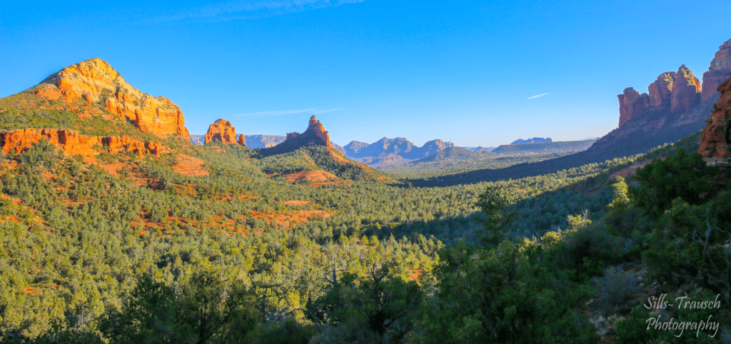
Brins Mesa starts at the Jim Thompson Trailhead at the end of Jordan Road and follows a dry wash up Mormon Canyon to an open mesa with long views of Wilson Mountain and the buttes north of town. Charred cypress snags from a 2006 wildfire still stand on top, with grasses and wildflowers filling in around them.
Pair it with the Soldier Pass and Cibola Pass trails for a loop of about 5.5 miles that also takes in Devil’s Kitchen and the Seven Sacred Pools. It is a handy way to see Soldier Pass on a weekend, since the Jim Thompson lot stays open to private cars when the shuttle runs.
Brins Mesa trail details
- Distance: 7 miles round trip on Brins Mesa alone; about 5.5 miles as a loop with Soldier Pass
- Elevation gain: About 650 to 900 feet
- Difficulty: Moderate
- Trailhead: Jim Thompson (Jordan) Trailhead at the end of Jordan Road
- Parking: Red Rock Pass required
13. Fay Canyon
Fay Canyon is a gentle stroll on a wide, sandy path between soaring red walls, and it pairs well with Bear Mountain or Boynton Canyon on the same day. About half a mile in, look right for an unmarked spur that climbs to Fay Canyon Arch. The arch blends into the cliff, and plenty of hikers walk right past it.
Small ruins sit beneath it, so leave them untouched.
The spur is short, steep, and rocky. The main trail ends a little over a mile in, where the canyon splits beneath tall cliffs.
Fay Canyon trail details
- Distance: About 2.4 miles round trip
- Elevation gain: About 200 feet, plus a steep climb on the arch spur
- Difficulty: Easy
- Trailhead: Fay Canyon Trailhead on Boynton Pass Road
14. Airport Loop

Airport Mesa gives you a sunrise or sunset with almost no effort. Drive up, walk a few steps from the lot, and watch the red rock glow as the sun slides down to your left.
For a proper hike, the Airport Loop circles the mesa below the runway for about 3.3 miles, with Cathedral Rock, Bell Rock, Courthouse Butte, Capitol Butte, and Coffee Pot Rock all in view along the way. Expect rocky, narrow sections and zero shade. The small trailhead pullout halfway up Airport Road fills quickly. A larger paid lot sits near the top of the mesa, and the Sedona View Trail links it to the loop.
Airport Loop trail details
- Distance: 3.3 to 3.5 miles (loop)
- Elevation gain: About 340 to 535 feet
- Difficulty: Moderate
- Trailhead: Airport Loop pullout on Airport Road
15. Bell Rock and Courthouse Butte Loop
This loop circles two of Sedona’s signature formations on a wide, well-signed trail, which makes it a good pick for families and first-time visitors. From the Bell Rock Vista Trailhead, follow the Bell Rock Pathway north, then swing east around Courthouse Butte through the Munds Mountain Wilderness and back to the car.
The hike is gradual throughout. The lower slopes of Bell Rock invite a scramble, though the upper sections steepen fast.
Bell Rock and Courthouse Butte Loop trail details
- Distance: About 3.8 miles round trip
- Elevation gain: About 300 feet
- Difficulty: Easy to moderate
- Trailhead: Bell Rock Vista Trailhead off SR 179, just north of the Village of Oak Creek
- Parking: Red Rock Pass required
16. West Fork of Oak Creek Canyon (Temporarily Closed)

Closed through at least Feb. 27, 2027. West Fork Trail No. 108, the Call of the Canyon Picnic Site, and the stretch of SR 89A that leads to them are all closed right now. Check the Coconino National Forest alerts page before planning around this hike.
West Fork is the hike I steer people toward in fall, when the hardwoods along the creek turn gold and scarlet beneath sheer sandstone walls. The trail stays mostly flat as it follows the creek upstream, crossing it again and again. You can keep your boots dry by rock hopping, though a slip or two comes with the territory. The hiking itself is easy. Still, plan on a full day so you can linger in the canyon and miss the rush-hour crawl back into Sedona.
Near the start, you walk past the crumbling ruins of a lodge that operated in the early 1900s, along with a few old apple trees. Most day hikers turn around about 3.3 miles in, where the canyon tightens, and the path gives way to wading. The full trail runs roughly 14 miles up toward the Flagstaff side of the canyon.
The 2026 Pocket Fire burned across the West Fork watershed, and later storms sent boulders and flood debris over the trail. The Forest Service has closed the trail and surrounding drainage, and entering the closure can result in fines. Before it reopens, the agency must consult with the U.S. Fish and Wildlife Service because the creek is habitat for the threatened narrow-headed garter snake. Crews are also weighing a reroute, so the trail you hike after it reopens may differ from the one described here.
West Fork trail details (as of its last opening)
- Distance: About 6.6 miles round trip to the usual turnaround; roughly 14 miles end to end
- Elevation gain: About 250 feet (5,280 to 5,520 feet)
- Difficulty: Easy to moderate, with repeated creek crossings
- Trailhead: Call of the Canyon Picnic Site on SR 89A, about 10.5 miles north of the Sedona roundabout
- Parking: Concessionaire-run lot, $15 per vehicle per day (covers up to five people) when open. The Red Rock Pass is not valid here. In fall, the lot fills by mid-morning, and the highway shoulders are posted no parking.
- Status: Closed through at least Feb. 27, 2027
Planning Your Sedona Hiking Trip
When to visit
March and April are my favorite months, with cool mornings and long days. October through December runs a close second.
Summer highs reach the upper 90s or low 100s, so start early if you visit and remember to drink plenty of water. Sedona also gets a beautiful snowstorm once or twice most winters, and red rock under fresh snow is a sight worth chasing.

How many days do you need hiking in Sedona?
A weekend gives you a solid introduction and room for two or three of these hikes. Four or five days lets you mix long summits like Wilson Mountain with sunset outings and avoid battling with the crowds if you don’t want to.
Plus, you might not want to hike every day. Visiting Slide Rock State Park is a great way to cool off and relax during the summer.
Where to stay
There are plenty of hotels in Sedona to choose from. Keep in mind prices rise during the busy season. Browse Sedona hotels on your own.
- Budget-friendly: Los Abrigados Resort and Spa
- Mid-range: Arabella Hotel Sedona
- Splurge: Enchantment Resort, right at the Boynton Canyon trailhead
Planning more than hikes? Read my 16 best things to do in Sedona, browse my photos of Sedona, or see my 26 best hikes in Arizona.
More Photos of Sedona’s Hiking Trails
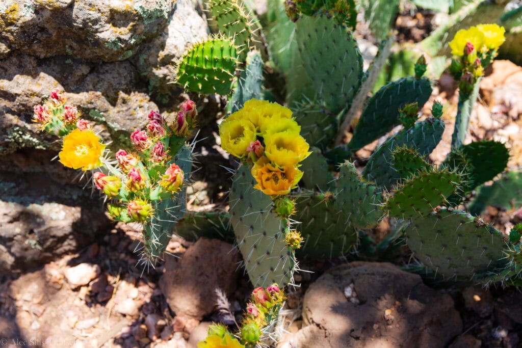
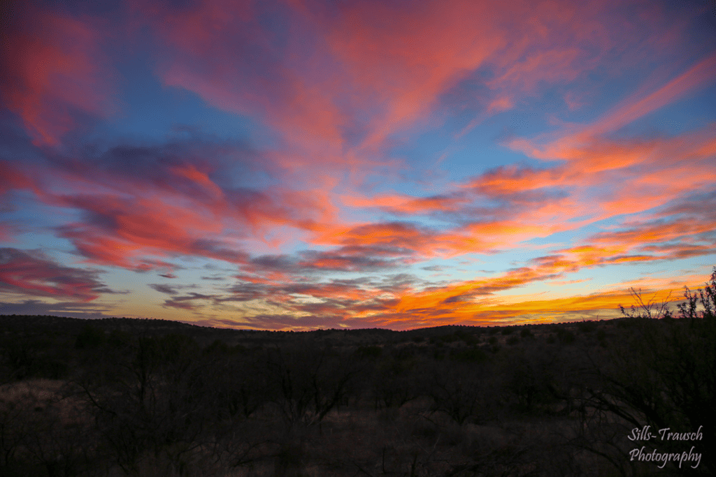
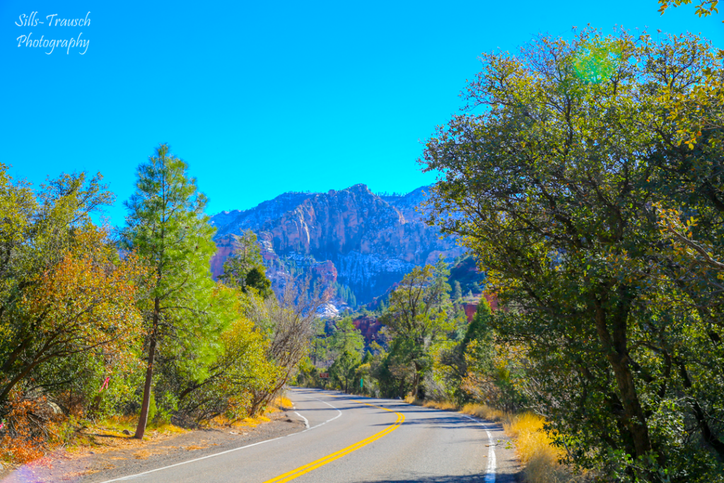
More images from the best hikes in Sedona.









Sedona Hiking FAQ
You need a Red Rock Pass or an America the Beautiful pass to park at most developed trailheads. Hiking itself is free, and riders on the free Sedona Shuttle do not need a pass. Concessionaire-run sites such as Call of the Canyon charge their own fee and do not accept the Red Rock Pass.
Secret Slickrock, the Birthing Cave, Fay Canyon, and the Bell Rock and Courthouse Butte Loop all stay mellow while delivering big red rock scenery. Doe Mountain and the walk to the Seven Sacred Pools on Soldier Pass add a little more climbing.
Wilson Mountain and Bear Mountain are the big climbs, each gaining roughly 2,000 feet or more. The Hangover Trail has less elevation gain but runs along exposed ledges.
Many Sedona trails enter the Red Rock-Secret Mountain or Munds Mountain wilderness areas, where drones are not allowed. Bear Mountain, Soldier Pass past the pools, and Wilson Mountain all fall inside wilderness boundaries.
Dogs are generally allowed on Coconino National Forest trails as long as they stay leashed. Skip scrambles like Cathedral Rock and Keyhole Cave with a dog, and remember that slickrock gets hot enough to burn paws in summer.
Final Thoughts on the Best Hikes in Sedona
Is Sedona crowded? Yes. But that doesn’t mean there isn’t room for you to go get out and enjoy the best hikes in Sedona. Thanks to the new shuttle system, it greatly helps alleviate some of the parking woes for popular trails.
But there are still plenty of options out there to hit the red dirt and enjoy time in nature.
I’m nearly certain you will have a surreal time in Red Rock Country and plan many more trips to explore this sacred area.
Until next time, adventurers, stay safe.
Follow on social media: TikTok || Instagram || Facebook || Newsletter | YouTube