6 incredible hikes to do in the Superstition Mountains
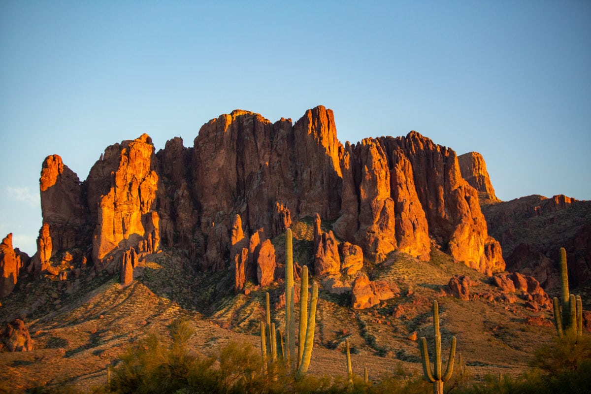
An hour east of Phoenix is the glorious Superstition Mountains. The Superstitions are an ideal place to do some Arizona hiking and adventuring while in Phoenix. It’s full of beautiful hikes, stunning cacti and saguaros, and, if you time it right, flowing rivers. Heading out to the Superstition mountain hiking trails will allow you to leave city life behind and immerse yourself in nature.
For those visiting in the summer, I would not advise you to do these if you are unaccustomed to hiking in the Arizona heat. Even if you are accustomed, I wouldn’t recommend the longer ones. But in great weather, these Superstition Mountain trails are phenomenal.
Here are six hikes that I think are the best to do in the Superstitions with a wide degree of difficulty.
A Hiking Guide to the Superstition Mountains
What is the best time to hike in the Superstitions?
The ideal time to hike in the Superstition Mountains is October through May. Daytime temperatures are moderate, and you can spend all day on the trails.
Keep in mind that weekends will be busy during these months, and if you want a hassle-free parking experience, get there before 8 am.

How to get to the Superstition Mountain hikes?
The Superstition Mountains have various access points, and the same goes for the best hikes listed here. You can access them from Lost Dutchman State Park (fee required), Peralta Canyon Road (well-maintained dirt rod), First Water Trailhead (also well-maintained dirt road), and the Tortilla Flat area.
From central Phoenix, it will take you between 50 minutes and 90 minutes to reach your destination.
What hiking clothes should I wear?
Make sure to wear moisture-wicking clothes that protect your skin from the sun. You’ll want the following:
- Hiking Poles
- Sunglasses
- Hiking shorts or pants
- Day pack with lots of water
What is the hardest hike in the Superstitions?
This has two answers. If you are okay hiking from one car to another, the Ridgeline Hike is the hardest and best of the Superstition mountain hiking trails. You start/end at Lost Dutchman State Park and start/end at Carney Springs Trailhead.
However, if you’re looking for an out-and-back, I would say either Superstition Peak 5057 or Battleship Mountain.
The 6 best hikes in the Superstition Mountains
Superstition Peak 5057

8 miles RT, 3,100 feet of elevation gain, All Trails Map
This is the hardest hike in the area, with over 3,100 feet of elevation gain during the four miles up. When you get to the top, you’re at the top of the Superstition Mountains at 5,059 feet, and you have a full view of the Phoenix metro area. As you hike up into the canyon, the trail has carins helping guide you.
After two miles, you’ll have hit the first saddle and will now be hiking in a basin. The trail is pretty easy to follow at the state. But after a while, once you pass the small creek (depending on the season), the trail will likely be overgrown. I’d recommend wearing pants to keep your legs from being chewed up. Once at the top, there’s a summit register. Make sure to sign your name!
I did half of this hike when it snowed in Phoenix back in 2019. Crazy huh!?
Flatiron via Siphon Draw


5.5 miles RT, 2,600 feet of elevation gain, All Trails Map
Easily the most well-known of the Superstition Mountain hikes. This is a short but steep trek, which gives you unsurpassed views of Phoenix. No matter the time of year, this hike is popular, as it gives you a nice workout without spending too long hiking.
The trail scurries up the canyon and drops you off near the summit, where you can hang out. Once you’re in the canyon, keep your eye out for blue and white dots. These will help guide you. If you can’t see them, stay left most of the way, and you’ll be good.
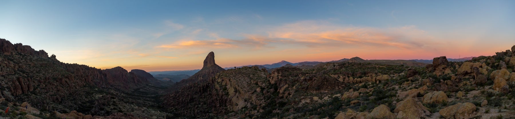
Fremont Saddle and Weavers Needle

6 miles RT, 1,500 feet of elevation gain, All Trails Map
A classic Arizona hiking trail. Technically called Peralta Trail to Fremont Saddle, this hike gives you a dead-on view of Weavers Needle from the south. The trail is straightforward and will likely only take 75 minutes to get to the saddle.
I should note that the parking lot can fill up quickly on the weekends, so plan to either get there early or late for a sunset hike. Lastly, it’s one of my favorite Superstition Mountain hikes, and you can even backpack here if you like.
Black Mesa and Lost Dutchman Loop


6 miles RT (Black Mesa) 9 miles RT for the full loop, All Trails Map
A moderately difficult Superstition Mountain hiking trail, mostly due to the length if you do the full loop, the hike to Black Mesa is a beautiful walk in the Arizona desert. If you go in the spring, water will flow around you. Once on top of Black Mesa, you’ll be in a sea of cholla cacti with a view of Weavers Needle from the north.
The only elevation gain is getting to the top of the Black Mesa plateau, but it’s not hard at all.
Wave Cave
3 miles RT, 900 feet of elevation gain, All Trails Map
Starting at the same trailhead as Superstition Peak 5057, you split left towards the Wave Cave at a big rock pile about a quarter-mile in. This trail gingerly gains elevation over the course of the hike until the end. Then, you have to hike up a steep slope that doesn’t have great traction.
However, this isn’t a long or dangerous segment, and you’ll quickly be in the cave and out of the sun. Many people are in love with this Superstition mountain hiking trail, but I would say it’s not my favorite. It’s too short and too busy.

Boulder Canyon

At nearly nine miles round trip, this is a fantastic trail that doesn’t get a ton of traffic. You start from Tortilla Flat, off of Canyon Lake. I will note that the trail doesn’t really end anywhere if you’re looking on AllTrails. So this can be a choose-your-own-adventure hike. I stopped at the 2.5-mile mark to enjoy the views.
People do use this to summit Battleship Mountain, which is a phenomenal Superstition Mountains hike that I sadly haven’t done.
Final Thoughts on Superstition Mountain Hiking Trails
Enjoy your time out in the mountains, and remember to bring plenty of water no matter the time of the year.
Until next time, adventurers, stay safe.
Follow on social media: TikTok || Instagram || Facebook || Newsletter | YouTube