
Trail Report: Cascade Pass and Sahale Arm in the North Cascades
The jagged peaks of the North Cascades are a mountaineer’s dream. They are challenging, mesmerizing, and full of new opportunities. Some of the most beautiful views in the West are just slightly below those peaks. Just inside the borders of North Cascades National Park is the Cascade Pass to Sahale Arm hike.
I’ve now hiked this trail three times, so I’ve updated this guide with the details you need to plan a trip, from the drive up Cascade River Road to landing a permit for Sahale Glacier Camp. Picture mountain goats grazing on heather benches while Doubtful Lake glints in its cirque far below Sahale Peak!
Easy Booking: Expedia.com | Hotels.com | VRBO | Booking.com | Airbnb.com
Need Gear: Find Gear at REI
Find Awesome Tours: Viator.com or GetYourGuide.com
First time here? Stay in touch by following on IG: @Alecoutside and my newsletter
Purchase my 2027 Scenic Calendar
Please stay safe out there and follow Leave No Trace principles as best you can.
Hiking Guide to Cascade Pass and Sahale Arm in North Cascades National Park
Quick Hiking Stats for Cascade Pass and Sahale Arm
- Distance: 7.4 miles round trip to Cascade Pass; 11.8 miles round trip to Sahale Glacier Camp
- Elevation Gain: 1,700 feet to Cascade Pass; 3,940 feet to Sahale Glacier Camp
- Difficulty: Moderate to Cascade Pass; Strenuous to Sahale Glacier Camp
- Time on Trail: 3-5 hours to the pass; 7-9 hours to the glacier
- Beauty Level: Gorgeous
- Best time to hike: Sunset with a walk down in the dark
- Season: Mid-July through September

What you need to know to plan your trip
Reaching the Cascade Pass Trailhead
What is the road quality to reach the trailhead?
About a 3-hour drive from Seattle, the final 13 miles are on a dirt road (the park says it is not suitable for sedans or low-clearance vehicles) that eventually winds you up to the trailhead.
Cascade River Road leaves State Route 20 at Marblemount and runs 23.1 miles to the trailhead. The first 10 miles are paved. After that, expect gravel with potholes and washboard, and plan on roughly an hour from Marblemount. The last 3 miles past the Eldorado parking area climb steeply on a narrow shelf with sheer drop-offs and few places to pass, so take it slow.
Trailers are prohibited inside the park boundary at mile 18, along with any vehicle longer than 22 feet or wider than 8 feet. Recent trip reports describe sedans making it up after the road has been graded, though ruts and washouts can appear after storms. Check the park’s road conditions page before you leave home.
The road usually opens to the trailhead by the end of June. Heavy snow years or storm damage can push that into July. Outside the season, a gate lower on the road blocks vehicles, though you can still walk or bike past it.
Parking at the trailhead
Once a lesser-known gem, this Washington destination has blossomed in popularity. Remember, if you plan to hike on the weekend, the parking lot will fill up quickly.
The lot at the end of the road is small for a trail this busy, and the park notes congestion from mid-July through early October. On summer weekends, cars spill down the road for a quarter mile or more. The park asks visitors to park only in designated areas and to keep the road and gates clear. Arriving early in the morning or hiking midweek makes this much easier.
Even if you have to wait for a spot, the view helps. Johannesburg Mountain rises straight out of the valley across from the lot, and on warm days you can hear ice tumbling off its hanging glaciers.
Do you need a pass or permit to hike?
There’s no entrance fee for North Cascades National Park, and the trailhead sits on federal land, so you don’t need a Northwest Forest Pass to park. Day hikers don’t need a permit either. You only need a wilderness permit if you plan to camp overnight, which I cover below.
Hiking Beta for Cascade Pass and Sahale Arm
Hiking to Cascade Pass
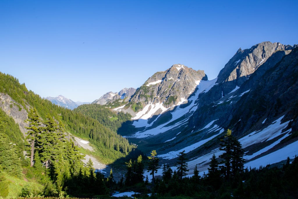
The first three miles are all switchbacks, taking you higher and higher on the mountainside through a sea of trees. Every once in a while, you’ll get a break in the trees to see mountains in the distance.
Most hikers count somewhere in the mid-30s for switchbacks. The grade is gentle, and the tread is smooth, which makes this section easy to descend by headlamp after sunset. Early in the season, steep snow can linger across the upper stretch of trail below the pass.
Once you leave the trees, the view of Cascade Pass becomes ever more apparent. The view there will not disappoint. It’s easily one of the best North Cascades hikes in the area.
The final stretch is a long, gradual traverse through open meadow to the pass at roughly 5,400 feet. Look east into Pelton Basin and the Stehekin River drainage. The park asks hikers to take breaks only on the trail or on rock as part of an ongoing revegetation effort at the pass, since heather is easily crushed.
Hiking up Sahale Arm
Once at Cascade Pass, take a quick breather, but don’t linger. The views will only get better as you ascend. The next mile or so will be steep, but Doubtful Lake will appear at the top of the ridge. It’s so pretty, with towering peaks behind it and snowmelt waterfalls running down the slopes.
Look for the signed junction just east of the pass and head left. The climb gains about 800 feet over a rocky mile to the ridge crest. From the top, a spur drops to the right to the shore of Doubtful Lake and gives back all of that elevation. It makes a good side trip if you have the legs, so budget extra time and energy for the climb back out.
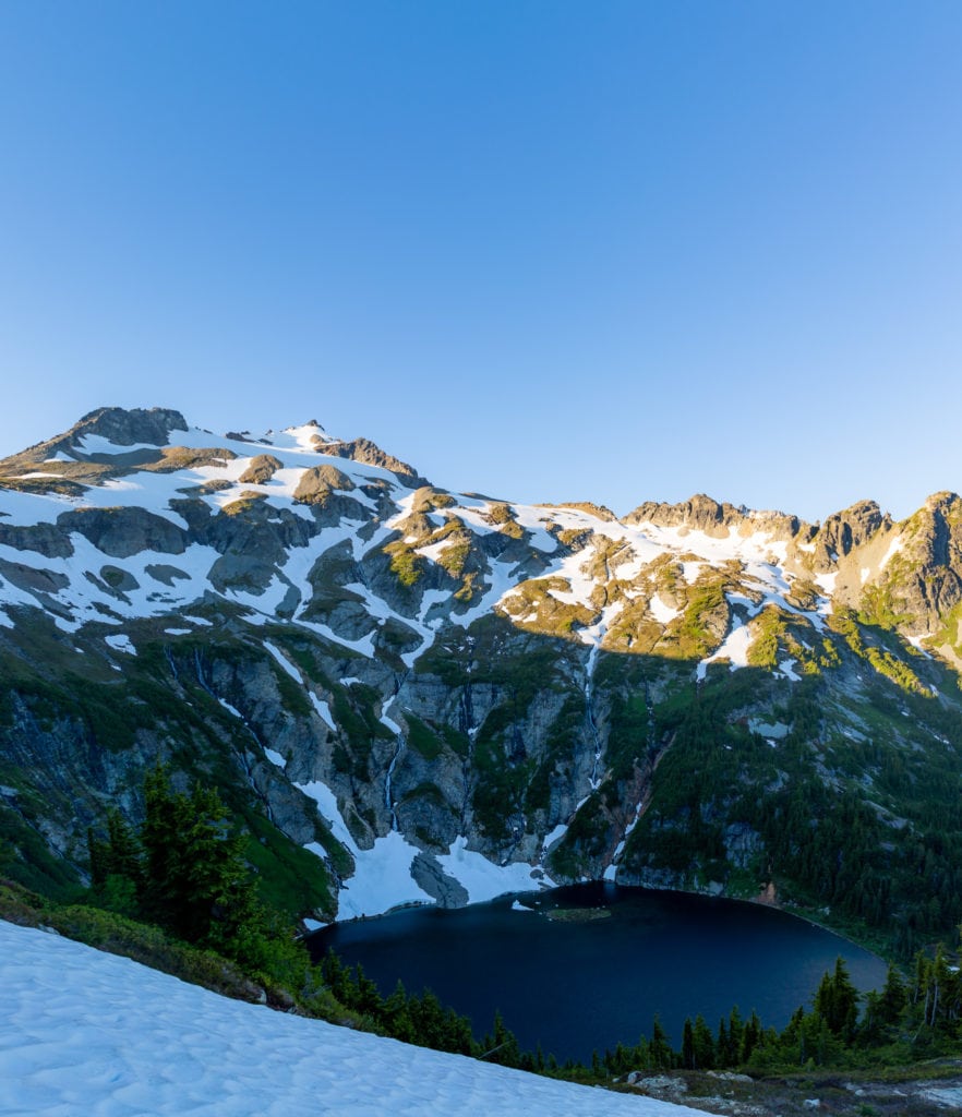
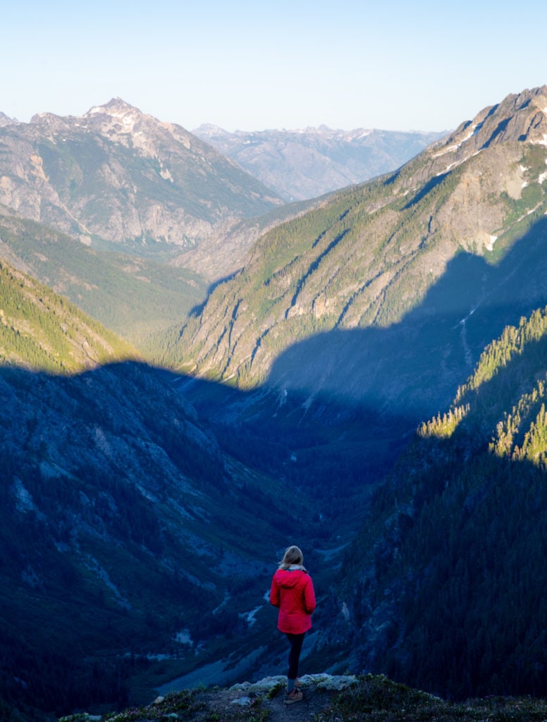

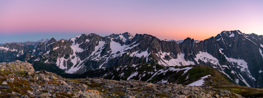
Some may call this the turnaround point, but you’ll notice a ridgeline on your left. That is Sahale Arm, and it’ll guide you up to Sahale Glacier Camp. Go as high as you feel comfortable, but it’s neither complex nor dangerous. At a certain point on the Arm, once you’ve started up the rocks, you’ll be able to see Mt. Baker peeking out on the horizon. You’ll also be able to look down at Doubtful Lake with the North Cascade Range fanning out behind it. The view is one of the best Washington can offer.
Above the Doubtful Lake junction, the trail follows the crest of the Arm through heather and wildflowers before the meadows give way to scree and moraine. The last pitch to Sahale Glacier Camp is loose and steep. If your legs are fading, the top of the heather meadows makes a fine turnaround point with nearly the same view. Beyond camp, the route onto the Sahale Glacier toward Sahale Peak is a glacier climb that requires mountaineering skills and gear.


When is the best time of year to hike Cascade Pass?
The primary hiking season runs from July until snow returns in mid-to-late September. In July, expect lingering snowfields and wildflowers, along with snowmelt waterfalls pouring off the slopes around Doubtful Lake.
The park warns that steep snow on this trail can require an ice axe as late as July, and Sahale Arm holds snow longer than the trail to the pass. A slip on a hard morning snowfield above the cirque can quickly turn serious. If you hike early in the season, carry an ice axe and know how to use it, or turn around at the first steep snow crossing.
August brings the steadiest weather, along with peak crowds and the occasional wildfire smoke. Check the park’s fire and closure updates before you go. By September, huckleberry and blueberry bushes start turning crimson across the meadows, and the weekend rush eases.
How hard is the hike?
Overall, the hike isn’t too hard. The trail to Cascade Pass is graded for a steady, moderate climb, and most reasonably fit hikers reach the pass in two to three hours.
Sahale Arm is where the effort ramps up. From the pass to the glacier, you’ll gain roughly 2,200 more feet in about 2.2 miles, with the steepest pitches right after the junction and again on the loose rock below camp. The full trip to Sahale Glacier Camp runs close to 12 miles with nearly 4,000 feet of gain, which the park rates as strenuous. Shade disappears once you leave the trees, so plan for full sun and save energy for the long descent.
Tips for hiking to Cascade Pass and Sahale Arm
- Bring a headlamp if you stay for sunset. The switchbacks are easy to follow in the dark.
- Start early on weekends if you want a spot in the main lot.
- Trekking poles help on the loose rock of the upper Arm and the long descent.
- Pack a wind layer. Gusts rake across the pass and the Arm even on warm August days.
- Rest only on the trail or on rock to protect the fragile heather.
- Drones are not allowed. National Park Service rules prohibit launching them in the park.
- Stock up on food and water before you leave State Route 20, since there are no services on Cascade River Road.
- For photographers, a wide lens covers Doubtful Lake from the Arm, and a telephoto lets you shoot mountain goats without crowding them.
Backpacking to Sahale Glacier Camp
Backpacking is only allowed with a wilderness permit here due to National Park regulations. However, you can score one online early in the year.
Reservations go through Recreation.gov. The early-access lottery opens in March (for 2027, applications run March 1 through March 12), and general reservations open in late April (April 29, 2027, at 7 a.m. Pacific). Expect to pay a $6 reservation fee plus $10 per person for anyone 16 and older.
Or you can secure one with a ‘walk-up’ permit from the Wilderness Information Center in Marblemount the day before your hike. This is a sought-after location, so plan to be there before 7:30 am.
The park holds back about 40 percent of sites for walk-ups. All permits for Cascade River Road trailheads, including reservations, must be picked up in person at the Wilderness Information Center. A reservation isn’t a permit until you pick it up, and you must do so by 11 a.m. on your start date. If you’re running late, email the center to hold your sites. In 2026, the center was open from mid-May to early October, from 7 to 11:30 a.m. and 12:30 to 4 p.m.
Sahale Glacier Camp has only a handful of sites, with parties capped at four people. Campfires are banned, and bear canisters are required. If Sahale is full, Pelton Basin on the east side of the pass is a lower alternative. Camping directly at Cascade Pass is not allowed.


Other Information about the Cascade Pass Hike
How crowded is this trail?
The National Park Service calls Cascade Pass the park’s most popular day hike, and summer weekends draw a steady stream of hikers. Weekday and September visits are calmer. Fewer people continue up Sahale Arm, so the upper ridge feels more spacious than the pass itself.
Are there any bathrooms?
Yes. There’s a pit toilet at the trailhead and a composting toilet at Sahale Glacier Camp. There’s nothing in between, so follow Leave No Trace practices and pack out your toilet paper.
Are dogs allowed on the trail?
No. Pets are not allowed on trails in North Cascades National Park, including this one.
Will I have cell service?
Don’t count on it. Service fades on Cascade River Road and is unreliable at the trailhead and on the trail. Download offline maps and tell someone your plans before you leave Marblemount.
What wildlife will you see?
Hoary marmots and pikas live in the talus around the pass, and deer and the occasional black bear turn up in the meadows. Mountain goats wander along Sahale Arm, sometimes right on the trail. Give them plenty of room and never feed any wildlife. The park also asks visitors to store food properly in parking areas and along Cascade River Road.
Can you continue past Cascade Pass?
Yes. East of the pass, the trail drops into Pelton Basin and continues toward Stehekin. A popular side trip branches into Horseshoe Basin, a steep-walled cirque with waterfalls and a historic mining site. Through-hikers can walk about 23 miles from the Cascade Pass lot to High Bridge to catch the Stehekin shuttle. The Stehekin Valley took heavy flood damage in December 2025, so confirm shuttle service with the park before planning that route.
Campgrounds in the area
There’s no camping at the trailhead. These are the closest frontcountry options:
- Marble Creek Campground (Cascade River Road, about 8 miles from Marblemount)
- Goodell Creek Campground (State Route 20, near Newhalem)
- Newhalem Campground (State Route 20, Newhalem)
- Colonial Creek Campground (State Route 20, Diablo Lake)
Water Sources
Carry most of your water from the trailhead. Snowmelt streams cross the upper trail in early and midsummer, and the glacier feeds runoff near camp, but flows dwindle by September. Filter or treat anything you collect, and plan on at least three liters for the full climb to Sahale Glacier Camp.
Final Thoughts on hiking to Cascade Pass or Sahale Arm
This is hands down one of the best (and most popular) trails in North Cascades National Park. Cascade Pass is a phenomenal place to stop if you don’t want ot push yourself. But if you can get up to at least a view of Doubtful Lake, you’re doing good!
And then, if you can keep going up onto Sahale Arm, you’re in for a real treat. This is a special region, and each moment here is worth it.
Until next time, adventurers, stay safe.
Follow on social media: TikTok || Instagram || Facebook || Newsletter | YouTube