
All 64 US National Parks: Full A-Z List
The best thing America has ever done was protect our greatest natural resources: National Parks and public lands. It’s truly our greatest idea. Inside is the full list of all 64 National Parks, with a short blurb about each epic location.
Enjoy this list of all 64 National Parks in the United States.
Acadia National Park

Acadia spreads across Mount Desert Island, the Schoodic Peninsula, and Isle au Haut, where pink granite headlands meet spruce-fir forest and the cold Gulf of Maine. Cadillac Mountain rises 1,530 feet and catches the first sunrise light in the United States from early October through early March, and the summit road requires a vehicle reservation from late May through October. Beyond the hiking trails, 45 miles of broken-stone carriage roads financed by John D. Rockefeller Jr. loop past ponds and hand-cut granite bridges, and they remain closed to cars.
Location: Maine
American Samoa National Park

The only U.S. national park south of the equator spans portions of Tutuila, Ofu, Olosega, and Ta‘ū, and the National Park Service leases its land from local villages. Paleotropical rainforest climbs from coral reefs to Lata Mountain, the territory’s high point at roughly 3,170 feet, while Samoan flying foxes with wingspans near three feet roost in the canopy. The shallow lagoon off Ofu Beach holds dense coral gardens that reward snorkelers who make the trip from Tutuila.
Location: American Samoa
Arches National Park

More than 2,000 documented sandstone arches sit within Arches’ 76,000-plus acres outside Moab, formed as a buried salt bed shifted beneath the Entrada Sandstone and let water and frost carve the rock into fins. Landscape Arch stretches 306 feet across, one of the longest natural spans on earth. The three-mile round-trip hike to the 52-foot Delicate Arch is the park’s signature walk, best timed for late-afternoon light.
Location: Utah
Badlands National Park

Badlands protects 244,000 acres of eroded buttes and one of the country’s largest undisturbed mixed-grass prairies, where bison, bighorn sheep, and reintroduced black-footed ferrets roam. Its soft sediment wears away at about an inch per year, exposing fossils of rhino-like brontotheres and three-toed horses that paleontologists prepare in a working lab beside the Ben Reifel Visitor Center. The southern Stronghold Unit lies within the Pine Ridge Reservation and is co-managed with the Oglala Sioux Tribe.
Location: South Dakota
Big Bend National Park

Big Bend follows 118 miles of the Rio Grande along the Mexican border and contains the Chisos Mountains, the only range in the U.S. that sits wholly inside a national park. Emory Peak tops out at 7,832 feet above a Chihuahuan Desert floor that supports more bird, bat, and cactus species than any other national park. With a passport, visitors can cross the river at the Boquillas port of entry for lunch in the Mexican village on the far bank.
Location: Texas
Biscayne National Park

About 95 percent of Biscayne lies underwater, protecting a stretch of the Florida Reef, mangrove shoreline, and the northernmost Florida Keys within sight of the Miami skyline. The Maritime Heritage Trail links six shipwrecks for divers and snorkelers, and Boca Chita Key draws boaters to its 65-foot ornamental lighthouse built in the 1930s. Most visitors explore by private boat or on concessioner tours departing the Dante Fascell Visitor Center at Convoy Point.
Location: Florida
Black Canyon of the Gunnison National Park

The Gunnison River has spent roughly two million years cutting through 1.7-billion-year-old Precambrian rock here, carving a gorge that plunges 2,722 feet at Warner Point. The Painted Wall, streaked with pale pegmatite bands, stands 2,250 feet tall as Colorado’s highest cliff, and parts of the canyon floor receive as little as 33 minutes of direct sunlight a day. Permits are required for unmarked inner-canyon routes that descend loose, steep gullies to the river.
Location: Colorado
Bryce Canyon National Park

Bryce is a series of horseshoe-shaped amphitheaters on the edge of the Paunsaugunt Plateau, holding the largest concentration of hoodoos on earth. Frost wedging on more than 200 days a year splits the pink and orange Claron limestone into spires, and the rim sits between 8,000 and 9,100 feet. The Navajo Loop and Queen’s Garden trails combine into a three-mile descent among the formations, and on moonless nights the park’s dark skies reveal some 7,500 stars.
Location: Utah
Canyonlands National Park

The Green and Colorado rivers carve Canyonlands into four districts: Island in the Sky, the Needles, the Maze, and the rivers themselves. Island in the Sky perches roughly 1,000 feet above the White Rim, and photographers gather before dawn to frame the sunrise glow beneath Mesa Arch. The Maze counts among the most remote terrain in the lower 48, while Horseshoe Canyon holds the Great Gallery, a panel of life-size Barrier Canyon Style pictographs painted thousands of years ago.
Location: Utah
Capitol Reef National Park

Capitol Reef follows the Waterpocket Fold, a nearly 100-mile monocline where the earth’s crust buckled and tilted layers of sandstone on edge. Pioneer-planted orchards in the Fruita Historic District still hold about 3,000 fruit trees open for seasonal picking, and the Gifford Homestead sells fresh-baked pies in season. Fremont culture petroglyphs along Highway 24 depict bighorn sheep and broad-shouldered human figures etched centuries ago.
Location: Utah
Carlsbad Caverns National Park

Beneath a Chihuahuan Desert ridge, sulfuric acid dissolved a Permian-era fossil reef, forming more than 119 caves, including the Big Room, a single chamber covering about 8 acres. The Natural Entrance trail descends roughly 750 feet over 1.25 miles past stalactites, columns, and draperies into the main cave. From late spring through October, hundreds of thousands of Brazilian free-tailed bats spiral out of the entrance at dusk while rangers narrate from an outdoor amphitheater.
Location: New Mexico
Channel Islands National Park

Five of the eight Channel Islands make up this park off the Ventura County coast, and their isolation has produced about 145 species found nowhere else, including the house-cat-sized island fox. Kayakers paddle into sea caves along Santa Cruz Island, home to Painted Cave, which runs nearly a quarter mile into the cliffs. Island Packers runs boats from Ventura and Oxnard, and because the islands have no food service, visitors pack everything they need.
Location: California
Chiricahua National Park
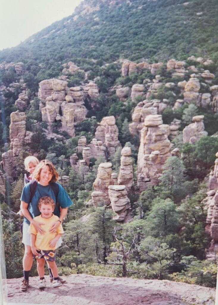
Chiricahua became the 64th national park in October 2026, protecting about 12,000 acres of the Chiricahua Mountains, a sky island rising from the desert grasslands of southeastern Arizona. Roughly 27 million years ago, the Turkey Creek Caldera erupted, burying the region in ash that fused into rhyolite tuff; erosion has since sculpted it into the spires and balanced boulders the Chiricahua Apache called the Land of Standing-Up Rocks. The eight-mile Bonita Canyon Drive climbs to Massai Point at 6,870 feet, and the Heart of Rocks Loop leads to Big Balanced Rock, a 1,000-ton boulder perched on a narrow pedestal.
Location: Arizona
Congaree National Park

Congaree protects the largest intact old-growth bottomland hardwood forest left in the southeastern U.S., where loblolly pines and cherrybark oaks form one of the tallest deciduous canopies on the planet. The 2.6-mile Boardwalk Loop threads among bald cypress knees, and the Cedar Creek Canoe Trail lets paddlers drift beneath the same trees. For a few weeks each May and June, synchronous fireflies flash in unison across the floodplain.
Location: South Carolina
Crater Lake National Park
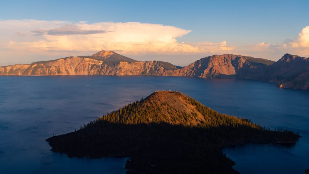
Crater Lake fills the caldera left when Mount Mazama erupted and collapsed about 7,700 years ago, and at 1,943 feet, it is the deepest lake in the United States. With no rivers flowing in or out, rain and snow alone sustain its cobalt water, and the rim averages more than 40 feet of snowfall each year. The 33-mile Rim Drive circles the caldera past Wizard Island, a cinder cone rising from the western side of the lake, and the steep Cleetwood Cove Trail is the only route down to the water.
Location: Oregon
Cuyahoga Valley National Park

Cuyahoga Valley follows 22 miles of the Cuyahoga River between Cleveland and Akron, a waterway whose 1969 fire galvanized the national push for the Clean Water Act. Cyclists ride the Ohio & Erie Canal Towpath Trail through the valley and can flag down the Cuyahoga Valley Scenic Railroad for a cheap ride back with their bikes. Brandywine Falls drops 60 feet over layered sandstone and shale, and the restored Beaver Marsh, once an auto salvage yard, now draws herons and beavers.
Location: Ohio
Death Valley National Park

Death Valley covers about 3.4 million acres, making it the largest national park in the lower 48, and its Badwater Basin salt flat sits 282 feet below sea level. Furnace Creek holds the world record for air temperature at 134°F, set in July 1913, while Telescope Peak rises to 11,049 feet just 15 miles from Badwater. Out on Racetrack Playa, rocks nudged by thin sheets of wind-driven ice leave long trails across the dry lakebed.
Location: California, Nevada
Denali National Park and Preserve

Denali spans six million acres of subarctic taiga and tundra, crowned by its 20,310-foot namesake peak, the highest in North America, which rises about 18,000 feet from its base. Private cars may drive only the first 15 miles of the park road, so most visitors ride buses farther in to see grizzly bears, caribou, moose, Dall sheep, and wolves. Rangers still patrol the winter backcountry with dog teams, and the park kennels near headquarters host sled-dog demonstrations in summer.
Location: Alaska
Dry Tortugas National Park

About 70 miles west of Key West, Dry Tortugas is 99 percent open water surrounding seven small keys and the hexagonal Fort Jefferson, built from roughly 16 million bricks in the 1800s. Visitors reach Garden Key by the Yankee Freedom ferry or by seaplane, then snorkel the coral along the fort’s outer moat wall. Ponce de León named the islands for the sea turtles he found in 1513, and loggerhead and green sea turtles still nest on the beaches.
Location: Florida
Everglades National Park

Everglades protects 1.5 million acres of the slow-moving river of grass that Marjory Stoneman Douglas wrote about, making it the largest subtropical wilderness in the United States. It is the only place on Earth where American alligators and American crocodiles live side by side, sharing the park with manatees and the endangered Florida panther. The Anhinga Trail near Homestead offers close views of wading birds and gators, and the 15-mile Shark Valley loop leads to an observation tower at its midpoint.
Location: Florida
Gates of the Arctic National Park and Preserve

Gates of the Arctic lies entirely north of the Arctic Circle and covers about 8.4 million acres of the Brooks Range without roads or maintained trails. Its name comes from forester Bob Marshall, who described Frigid Crags and Boreal Mountain as a gateway to the Arctic. Most visitors fly in on bush planes from Bettles or Anaktuvuk Pass to backpack or float one of six designated Wild and Scenic Rivers, sharing the tundra with migrating caribou.
Location: Alaska
Gateway Arch National Park

Eero Saarinen’s stainless steel arch rises 630 feet over the Mississippi River riverfront in St. Louis, making it the tallest human-made monument in the United States. Five-seat tram pods carry visitors up the curved legs to an observation deck, offering views up to about 30 miles on clear days. Across the grounds, the Old Courthouse is where Dred and Harriet Scott first sued for their freedom in 1846.
Location: Missouri
Glacier National Park

Glacier National Park holds more than 700 miles of trails across the Crown Jewel of the Continent, and its Triple Divide Peak sends water toward the Pacific, the Atlantic, and Hudson Bay. The 50-mile Going-to-the-Sun Road crosses the Continental Divide at Logan Pass (6,646 feet), where mountain goats and bighorn sheep often graze near the visitor center. Around 150 glaciers existed here in 1850, and by 2015, only 26 remained large enough to qualify.
Location: Montana
Glacier Bay National Park and Preserve

When Captain George Vancouver sailed past in 1794, Glacier Bay was barely a dent in a wall of ice, and that ice has since retreated about 65 miles up the bay. Tidewater glaciers like Margerie calve into the inlets today, and humpback whales feeding in the bay make it a prime spot for whale watching by cruise ship, day boat, or kayak from Bartlett Cove. At Bartlett Cove, the Huna Tlingit tribal house Xunaa Shuká Hít honors the people whose ancestral homeland the advancing ice once overran.
Location: Alaska
Grand Canyon National Park

The Colorado River has cut the Grand Canyon, 277 river miles long, up to 18 miles wide, and more than a mile deep, exposing rock nearly 2 billion years old at the bottom. The South Rim stays open year-round, while the North Rim sits about 1,000 feet higher and closes to vehicles during winter snows. Hikers descend corridor trails like the Bright Angel and South Kaibab, and multi-day rafting trips through the inner gorge often book a year or more in advance.
Location: Arizona
Grand Teton National Park

With no foothills to soften them, the Tetons rise roughly 7,000 feet straight up from the Jackson Hole valley floor to the 13,775-foot summit of the Grand Teton. The range is among the youngest in the Rockies, lifted along the Teton Fault over the past 10 million years, yet its core holds 2.7-billion-year-old gneiss. Photographers working in Grand Teton National Park gravitate to the Mormon Row barns, Oxbow Bend, and the Snake River Overlook that Ansel Adams made famous in 1942.
Location: Wyoming
Great Basin National Park

Great Basin National Park climbs from sagebrush desert to 13,063-foot Wheeler Peak, whose flanks shelter Nevada’s only glacier and groves of Great Basin bristlecone pines, some more than 3,000 years old. Guided tours of Lehman Caves wind past dense formations, including more than 300 rare shields. The remote eastern Nevada skies earned the park International Dark Sky Park status, and it hosts an astronomy festival each fall.
Location: Nevada
Great Sand Dunes National Park and Preserve
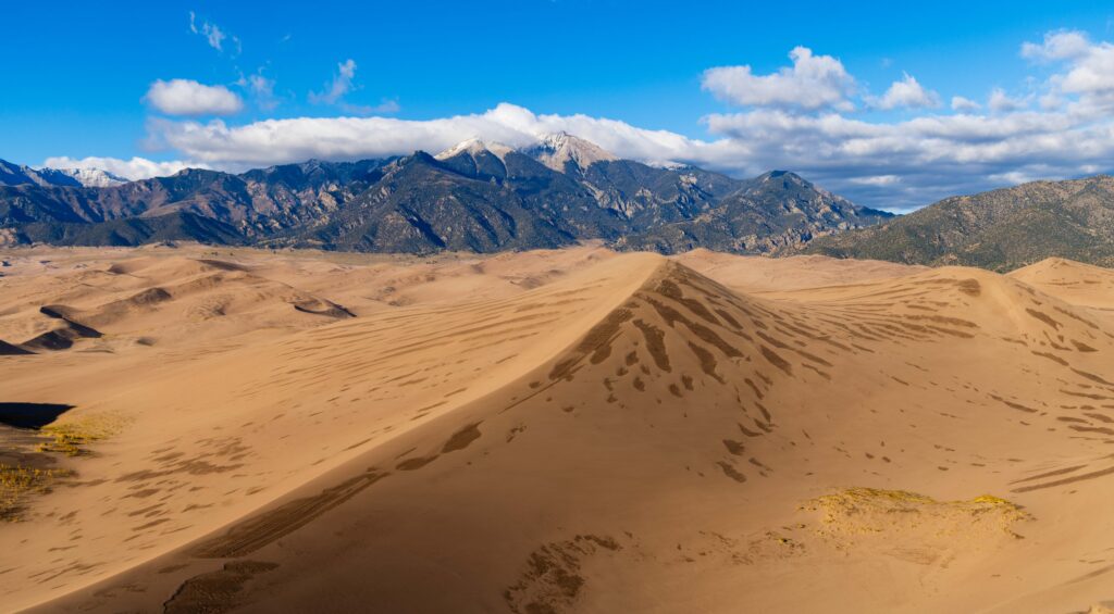
Star Dune rises about 750 feet in this park, the tallest dune in North America, part of a 30-square-mile dunefield piled against the Sangre de Cristo Mountains in the San Luis Valley. In late spring, snowmelt sends Medano Creek across the base of the dunes in pulsing surge waves, creating a seasonal beach for wading while visitors sled and sandboard the slopes above. Beyond the sand, the park and preserve extend into the Colorado Rockies, where trails climb to alpine lakes beneath 13,000-foot peaks.
Location: Colorado
Great Smoky Mountains National Park

Great Smoky Mountains is the most visited national park in the country, logging around 12 million recreation visits a year, in part because it charges no entrance fee. About 30 species of salamanders live in its damp hardwood coves, earning it the nickname Salamander Capital of the World, and Kuwohi, formerly Clingmans Dome, reaches 6,643 feet. In Cades Cove, preserved log cabins and churches line an 11-mile one-way loop where black bears and white-tailed deer graze the meadows.
Location: North Carolina, Tennessee
Guadalupe Mountains National Park

Guadalupe Peak, Texas’s highest point at 8,751 feet, crowns a range built from the Capitan Reef, one of the best-preserved Permian fossil reefs on earth, dating to about 265 million years ago. The 8.4-mile round-trip summit trail gains about 3,000 feet, and El Capitan’s sheer limestone face anchors the view from below. Each fall, bigtooth maples in McKittrick Canyon turn crimson and gold, drawing hikers to one of West Texas’s rare autumn displays.
Location: Texas
Haleakalā National Park

Haleakalā’s 10,023-foot summit looks into a cinder-strewn depression roughly seven miles long and 2,600 feet deep, and a reservation is required to drive up for sunrise. Endemic ʻāhinahina, or silverswords, bloom once after decades of growth and then die, and endangered nēnē geese forage on the volcano’s upper slopes. On the coast, the Kīpahulu District’s Pīpīwai Trail climbs through a bamboo forest to 400-foot Waimoku Falls.
Location: Hawaii
Hawai’i Volcanoes National Park

Hawai‘i Volcanoes protects the summits of Kīlauea and Mauna Loa, and Kīlauea’s Halemaʻumaʻu crater has erupted repeatedly in recent years, sending lava fountains hundreds of feet high. The 19-mile Chain of Craters Road descends about 3,700 feet to the sea across old lava flows, ending near the Hōlei Sea Arch. Native Hawaiians regard Kīlauea as the home of Pele, the goddess of volcanoes, and visitors can walk through Nāhuku, a tree-fern-shaded lava tube.
Location: Hawaii
Hot Springs National Park

Congress set aside the thermal springs here in 1832, 40 years before Yellowstone, making Hot Springs the oldest federally protected area in today’s National Park System. Rainwater that fell about 4,400 years ago resurfaces at 143°F from 47 springs, and the Buckstaff Bathhouse still offers traditional soaks along Bathhouse Row. The Fordyce Bathhouse now serves as the visitor center and museum, while Superior Bathhouse Brewery uses the thermal water to brew its beer.
Location: Arkansas
Indiana Dunes National Park

Indiana Dunes stretches along 15 miles of Lake Michigan’s southern shore and supports more than 1,100 native flowering plant species, making it one of the most biodiverse parks in the system. Botanist Henry Cowles studied these dunes in the late 1890s to develop his theory of ecological succession, a cornerstone of American plant ecology. Mount Baldy, a living dune, creeps inland several feet a year, and five homes from the 1933 Chicago World’s Fair still stand along Lake Front Drive.
Location: Indiana
Isle Royale National Park

Isle Royale is a 45-mile-long island in northwestern Lake Superior, reachable only by ferry or seaplane from Michigan or Minnesota and closed from November through mid-April. Since 1958, researchers have tracked its wolves and moose in the world’s longest-running predator-prey study, and they relocated new wolves here in 2018 and 2019 after the original population nearly died out. Backpackers cross the island on the 40-mile Greenstone Ridge Trail, and paddlers link inland lakes and sheltered harbors.
Location: Michigan
Joshua Tree National Park

Joshua Tree sits where the higher Mojave Desert meets the lower Colorado Desert, a transition visible in the shift from Joshua tree woodlands to ocotillo and the dense Cholla Cactus Garden. Its rounded monzogranite boulders, weathered over millions of years, host more than 8,000 rock-climbing routes. Certified as an International dark sky Park in 2017, it draws stargazers to its eastern basins, where the Milky Way arcs over silhouetted yuccas.
Location: California
Katmai National Park and Preserve
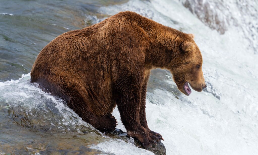
Katmai protects an estimated 2,200 brown bears, and in July and September they gather at Brooks Falls to catch leaping sockeye salmon from elevated platforms. Online viewers follow the same bears on live webcams and vote in the park’s Fat Bear Week each fall. The 1912 Novarupta eruption, the largest of the 20th century, buried the nearby Valley of Ten Thousand Smokes in ash up to 700 feet deep.
Location: Alaska
Kenai Fjords National Park

Nearly 40 glaciers flow from the 700-square-mile Harding Icefield, which covers more than half of this park on the Kenai Peninsula near Seward. Exit Glacier is the only part of the park reachable by road, and the strenuous Harding Icefield Trail climbs roughly 1,000 feet per mile for about four miles to an overlook of the ice. Day cruises out of Resurrection Bay pass tidewater glaciers along with humpback whales, orcas, Steller sea lions, and puffins.
Location: Alaska
Kings Canyon National Park

Managed jointly with neighboring Sequoia National Park, Kings Canyon holds one of North America’s deepest canyons, where the South Fork of the Kings River runs more than 8,000 feet below the surrounding peaks. In Grant Grove, the General Grant Tree ranks as the second-largest tree on Earth and serves as the Nation’s Christmas Tree. The Kings Canyon Scenic Byway descends into Cedar Grove, open from late spring to fall, where Zumwalt Meadow and Roaring River Falls sit beneath granite walls.
Location: California
Kobuk Valley National Park

Kobuk Valley lies just north of the Arctic Circle, and its Great Kobuk Sand Dunes cover about 25 square miles, with summer surface temperatures that can reach 100°F. Each spring and fall, the Western Arctic caribou herd swims the Kobuk River at Onion Portage, where people have hunted the migration for roughly 9,000 years. With no roads or visitor facilities, people reach the park by bush plane from Kotzebue or Bettles.
Location: Alaska
Lake Clark National Park and Preserve
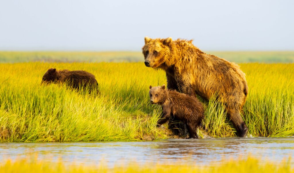
Coastal meadows at Silver Salmon Creek and Chinitna Bay make Lake Clark a prime destination for watching brown bears graze sedges and dig for clams. Inland, the Chigmit Mountains join the Alaska and Aleutian ranges and include two active volcanoes, Redoubt and Iliamna. At Twin Lakes, visitors can tour the hand-built cabin where Richard Proenneke lived alone for about 30 years, a life captured in the film Alone in the Wilderness.
Location: Alaska
Lassen Volcanic National Park

Lassen Peak, which erupted from 1914 to 1917, is one of the largest plug dome volcanoes on Earth, and the park contains all four types of volcanoes: plug dome, shield, cinder cone, and composite. The boardwalk at Bumpass Hell crosses a 16-acre basin of boiling mud pots, fumaroles, and steaming pools fed by the same volcanic system. The 30-mile park highway climbs past 8,500 feet and stays buried under snow for much of the year.
Location: California
Mammoth Cave National Park

Surveyors have mapped more than 420 miles of passageways at Mammoth Cave, the world’s longest known cave system, and new sections are still being charted. Rangers lead tours ranging from short walks to the flowstone of Frozen Niagara to crawling expeditions through tight crevices. Stephen Bishop, an enslaved guide in the 1830s and 1840s, explored and mapped many of the routes visitors follow today.
Location: Kentucky
Mesa Verde National Park

Ancestral Puebloans lived on and beneath this mesa from about 550 to 1300 CE, leaving nearly 5,000 archaeological sites, including some 600 cliff dwellings. Cliff Palace, North America’s largest cliff dwelling, has about 150 rooms and 23 kivas, and ranger-guided tours require advance tickets. The Balcony House tour has visitors climb a 32-foot ladder and crawl through a narrow tunnel to reach the alcove.
Location: Colorado
Mount Rainier National Park

Mount Rainier rises 14,410 feet and holds more glacial ice than any other peak in the contiguous U.S., feeding six major rivers. Subalpine meadows at Paradise fill with lupine and paintbrush in late July and August, and the area once recorded 1,122 inches of snow in a single winter. The 93-mile Wonderland Trail circles the entire mountain, gaining and losing about 22,000 feet along the way.
Location: Washington
New River Gorge National Park

Designated in 2020, New River Gorge protects 53 miles of a river geologists consider one of the continent’s oldest, along with the deep gorge it carved through the Appalachian Plateau. The New River Gorge Bridge spans 3,030 feet and rises 876 feet above the water; on Bridge Day each October, BASE jumpers leap from its deck. Rafters run Class IV and V rapids in the lower gorge, while climbers work more than 1,400 established routes on the sandstone cliffs.
Location: West Virginia
North Cascades National Park

North Cascades holds more than 300 glaciers, the most of any U.S. park outside Alaska, among jagged peaks often called the American Alps. Glacial flour suspended in Diablo Lake turns its water a milky turquoise visible from the State Route 20 overlook, though the highway closes over Washington Pass each winter. The Cascade Pass Trail climbs 3.7 miles to a saddle ringed by hanging glaciers and offers one of the park’s most accessible routes into the high country.
Location: Washington
Olympic National Park

Olympic National Park spans nearly a million acres of glaciated peaks, more than 70 miles of wild Pacific coastline, and temperate rainforests like the Hoh, which soak up 140 inches of rain or more each year. The park protects the largest unmanaged herd of Roosevelt elk in the Pacific Northwest, which grazes beneath moss-draped Sitka spruce and bigleaf maples. Removing two dams on the Elwha River between 2011 and 2014, the largest dam removal in U.S. history, reopened the river to returning salmon.
Location: Washington
Petrified Forest National Park

Logs that toppled some 218 million years ago in the Late Triassic were buried, infused with silica, and turned to quartz banded with iron and manganese hues. The 28-mile park road links the striped badlands of the Painted Desert and Blue Mesa with trails through the Crystal Forest, and it is the only national park that preserves a section of historic Route 66. Newspaper Rock holds more than 650 petroglyphs carved by Ancestral Puebloan people, some as old as 2,000 years.
Location: Arizona
Pinnacles National Park

Pinnacles formed from the Neenach Volcano about 23 million years ago, and the San Andreas Fault has since carried these spires roughly 195 miles northwest of their source. Since 2003, the park has managed a release site for endangered California condors, which visitors often spot soaring above the High Peaks Trail. Boulders wedged in narrow gorges create the Bear Gulch and Balconies talus caves, which close seasonally to protect a colony of Townsend’s big-eared bats.
Location: California
Redwood National and State Parks

One national park and three state parks jointly protect about 45 percent of the old-growth coast redwoods still standing, including Hyperion, the tallest known tree on Earth at roughly 380 feet. Hyperion’s location is off-limits, and visitors who bushwhack to it face fines, so most people walk established groves like Lady Bird Johnson and Tall Trees instead. Fern Canyon’s 50-foot walls of five-finger ferns appeared in Jurassic Park: The Lost World, and Roosevelt elk graze the prairies around Prairie Creek.
Location: California
Rocky Mountain National Park

Trail Ridge Road crosses the Continental Divide and tops out at 12,183 feet, the highest continuous paved road in the U.S., and about a third of the park lies above treeline in alpine tundra. Longs Peak, the park’s lone fourteener at 14,259 feet, draws climbers to the Keyhole Route, a roughly 15-mile round trip most parties begin in the dark. Each September and October, bull elk bugle across Moraine Park and Horseshoe Park during the rut.
Location: Colorado
Saguaro National Park

Saguaro’s two districts flank Tucson, protecting giant cacti that can live 150 years or more, reach 40 to 60 feet, and often take half a century to sprout their first arms. Waxy white saguaro blossoms, Arizona’s state flower, open at night in May and June to feed nectar bats and white-winged doves. In the western Tucson Mountain District, Signal Hill holds dozens of Hohokam petroglyphs, while the eastern Rincon Mountain District climbs to 8,666 feet through oak and pine forest.
Location: Arizona
Sequoia National Park

The General Sherman Tree in Giant Forest is the largest living tree on Earth by volume, at roughly 52,500 cubic feet and an estimated 2,200 years old. A staircase of about 350 steps climbs Moro Rock, a granite dome with views over the Great Western Divide, and guided tours enter the marble passages of Crystal Cave in summer. The park’s eastern boundary runs along the crest of the Sierra Nevada to Mount Whitney, at 14,505 feet, the highest summit in the contiguous U.S.
Location: California
Shenandoah National Park

Skyline Drive runs 105 miles along the crest of the Blue Ridge Mountains with about 70 overlooks, and peak fall color usually arrives in mid to late October. More than 500 miles of trails include 101 miles of the Appalachian Trail and the granite rock scramble up Old Rag. Creating the park in the 1930s displaced hundreds of mountain families, and exhibits at the Byrd Visitor Center tell their story.
Location: Virginia
Theodore Roosevelt National Park

Theodore Roosevelt first came to the rugged badlands of western North Dakota in 1883 to hunt bison, and the ranching years that followed shaped the conservation ethic of his presidency. The park splits into a South Unit near Medora, a less-visited North Unit, and the Elkhorn Ranch site along the Little Missouri River, where bison and elk graze the grasslands. Roosevelt’s Maltese Cross Cabin, moved from its original site, now stands behind the South Unit visitor center in Medora.
Location: North Dakota
Virgin Islands National Park

Virgin Islands National Park covers about 60 percent of St. John, much of it land that Laurance Rockefeller bought and donated to the federal government in 1956. Trunk Bay’s underwater snorkeling trail uses submerged signs to identify coral and fish, and the Reef Bay Trail descends through dry forest to Taíno petroglyphs beside a freshwater pool. On the north shore, the stone ruins of the Annaberg sugar plantation recall the enslaved Africans who worked the island’s cane fields.
Location: U.S. Virgin Islands
Voyageurs National Park

Named for the French-Canadian voyageurs who paddled birchbark canoes during the fur trade, this park on the Canadian border is nearly 40 percent water, and most of it can only be explored by boat. Visitors rent houseboats to cruise Rainy, Kabetogama, and Namakan lakes, camping on islands of Canadian Shield bedrock billions of years old. In winter, plowed ice roads open across the frozen lakes, and dark skies certified in 2020 set the stage for northern lights viewing.
Location: Minnesota
White Sands National Park

White Sands protects 115 square miles of the 275-square-mile Tularosa Basin dunefield, the largest gypsum dunefield on earth, where the sand stays cool underfoot even in summer heat. Visitors sled the dunes along the eight-mile Dunes Drive, and the bleached earless lizards and Apache pocket mice living here have evolved pale coloring to blend into the sand. In 2021, researchers dated fossilized human footprints in the park’s dry lakebed to between 21,000 and 23,000 years ago, among the oldest evidence of people in the Americas.
Location: New Mexico
Wind Cave National Park

Wind Cave became the first cave protected as a national park in 1903, and explorers have mapped more than 160 miles of its passages, ranking it among the longest caves in the world. It holds about 95 percent of the world’s known boxwork, thin calcite fins that form honeycomb patterns on the ceilings and walls. Above ground, mixed-grass prairie and ponderosa pine forest support bison, elk, and pronghorn, and the cave’s natural entrance figures in the Lakota emergence story.
Location: South Dakota
Wrangell–St. Elias National Park and Preserve

At 13.2 million acres, Wrangell–St. Elias is America’s largest national park, roughly the size of Yellowstone, Yosemite, and Switzerland combined, and it contains nine of the 16 highest peaks in the U.S. Its Malaspina Glacier spreads across the coastal plain in a lobe larger than Rhode Island. Most visitors drive the 60-mile gravel McCarthy Road toward Kennecott, a copper mining town abandoned in 1938, then hike out onto the Root Glacier.
Location: Alaska
Yellowstone National Park

Yellowstone became the world’s first national park in 1872, and it holds roughly half of the planet’s active geysers among more than 10,000 hydrothermal features atop a vast volcanic caldera. Old Faithful erupts about every 60 to 110 minutes, and Grand Prismatic Spring, the largest hot spring in the U.S., spans roughly 370 feet. In the Lamar Valley, wolves reintroduced in 1995 hunt elk and bison, and the park’s bison herd is the only one in the country to have lived in the same place continuously since prehistoric times.
Location: Wyoming, Montana, Idaho
Yosemite National Park

In 1864, Abraham Lincoln signed the Yosemite Grant to protect Yosemite Valley and the Mariposa Grove of giant sequoias, setting a precedent for the national park idea. Granite walls, including 3,000-foot El Capitan and Half Dome, rise over the valley floor, and Yosemite Falls drops 2,425 feet in three sections, making it one of North America’s tallest waterfalls. In mid to late February, the setting sun can turn Horsetail Fall a glowing orange, and hikers heading to Half Dome’s summit cables need a permit won through a lottery.
Location: California
Zion National Park

The Virgin River carved Zion Canyon about 15 miles long and up to half a mile deep into red and cream Navajo Sandstone, and a free shuttle replaces private cars on the canyon’s scenic drive for most of the year. Hikers wade upstream into The Narrows, where walls rise about 1,000 feet above a river only 20 to 30 feet wide in places, while Angels Landing’s chain-assisted final stretch requires a permit through a lottery. In the northwest corner, the Kolob Canyons District offers a five-mile scenic drive among less-visited finger canyons.
Location: Utah
Until next time, adventurers, stay safe.
Follow on social media: TikTok || Instagram || Facebook || Newsletter