
Your Guide to Exploring Arizona’s White Pocket in 2026
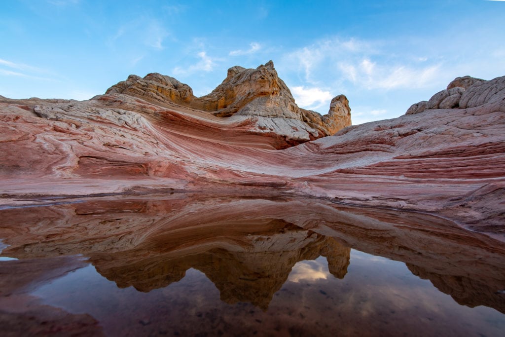
Straddling the Arizona and Utah border, White Pocket is a different world altogether. The wavy textures. The red, white, and orange colors. The dazzling display of nature’s powers. White Pocket is a place everyone should see for themselves.
A little over six hours from Phoenix, White Pocket, Arizona, is the perfect place to get off the grid, enjoy peace and quiet, and take amazing photographs. There are few places like this on Earth, and it is a must-see!
Below, we’ll dive into EVERYTHING you need to know about visiting White Pocket! So, let’s dive in.
Easy Booking: Expedia.com | Hotels.com | VRBO | Booking.com
Need Gear: Find Gear at REI
Find Awesome Tours: Viator.com or GetYourGuide.com
See More Travel and Hiking Inspiration: @Alecoutside
Iceland on your bucket list? Get my Iceland guide + 144 pinned locations on Google Maps
A Complete Guide to White Pocket in Arizona
Quick Details of White Pocket, Arizona
- Location: North of Vermillion Cliffs National Monument. Download the map beforehand.
- Drone Usage: Allowed
- Vehicle Type: 4×4 with high clearance (this is not a suggestion, but a mandate)
- Stay Length: Half day to two nights
- Utilities: None. Bring plenty of water and normal camping supplies
- Near: Vermilion Cliffs National Monument
- Best time: Spring and Fall
- Worst Time: Immediately after a storm or during one.
How to get to White Pocket
Best time to go
The best time to visit White Pocket is October through May, as you avoid the hot summer months. Even though it is in Arizona, White Pocket can see snow in the winter, and the road can be dicey if wet.
Keep this in mind if you explore over the winter months.
Via Phoenix
The road to White Pocket, Arizona, is extremely tricky and isn’t for the faint of heart or those without a proper 4×4 vehicle with high clearance. Coming from Phoenix, you’ll take I-10 to Flagstaff, then continue heading north on the 89A. After 3.5 hours, get off the 89A and head towards Marble Canyon and then the Vermillion Cliffs National Monument. From there, turn north onto House Rock Valley Road. After seven miles on this groomed dirt road, you’ll begin your trek to White Pocket.
Key details for arriving safely at White Pocket
Wait for Pine Tree Road. Google will tell you to take an early right. Do not do this.
Take a slight right onto Pine Tree Road. The road should be bumpy but doable for the next six to seven miles. At this point, you’ll pass an old ranch on your left. You can now go around it vs. through its gates. Stay to the right of the ranch, but take the road that will take you north. This is where the road will get very sandy. This is also where you leave Pine Tree Road.
If you can deflate and inflate your tires, this is an excellent spot to do so. Deflating your tires helps when driving through sand. Think around 15-20psi, but research your specific truck or SUV.
For the next eight miles, you’ll be driving on a sandy road with deep grooves on both sides. A low-clearance car without a 4×4 is likely to get stuck here. Although driving is relatively straightforward, be on the lookout for grazing cows.
Once you’re at the parking lot, you’re safe from the sand, and the exploration begins.
White Pocket and Vermilion Cliffs National Monument Camping
You can technically camp anywhere, but I’d recommend the back of the parking lot, away from the entrance area. This gives you some privacy from day-trippers. There is also no shade, so bring a canopy or some shade to protect you during the middle of the day.
Even in northern Arizona, it will get hot. Additionally, though hardly an afterthought, bring plenty of water.
What to bring camping
- Two-burner stove – A reliable two-burner stove is crucial to running an efficient camp kitchen. These will last you 5-10 years and give you no problems if you treat them right.
- Lightweight table – This will fold up nicely and allow for effortless transportation.
- Full cookset – Just like the stove, getting a good set means you won’t have to worry about replacing them for years and years.
- Egg holder – Honestly, one of my favorite food accessories as I never have to worry about my eggs getting crushed or having the egg cardboard disintegrate.
- Yeti Cooler – Keep all your food and drinks cold the entire weekend. Made for those going into the wild without access to ice for a few days
- Reusable Propane Tank
- Two Five-gallon water container
- Four-person tent
- Double sleeping bag – 30 degrees
Photos of White Pocket in Arizona


Exploring White Pocket
From the entrance, it is about a quarter-mile walk through the sand. Then, White Pocket will appear before you. At this point, it’s a free-for-all.
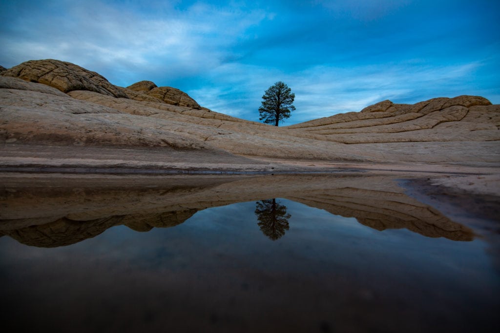
However, there are a few points I suggest, such as the lone tree, with hopefully a small pond at the bottom to create a reflection. And then there may be another small pond in the middle for another reflection shot.
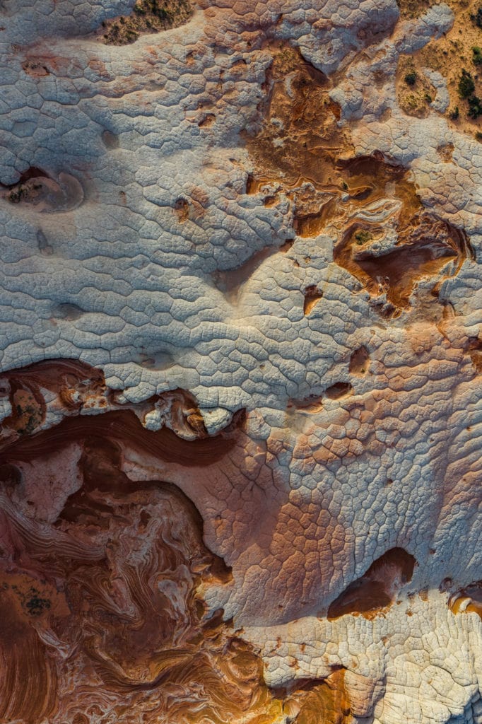
Other than that, it’s up to you. I’d also suggest launching your drone and seeing the landscape from above. White Pocket, Arizona, truly offers a spectacle like none other.


White Pocket FAQ
Can you get to White Pocket without a tour?
Yes, you can get to White Pocket without a tour if you have an appropriate SUV or truck. However, if you drive a sedan or do not want to stress yourself out driving on the sandy road, you can take a tour.
Do you need a permit for White Pocket?
As of December 2023, no permit is needed to access White Pocket. It’s only accessible by 4×4 and high-clearance vehicles, which have kept visitation numbers down, even though they have increased significantly over the last 4 years.
There is also no need for a camping reservation. Most people set up their tents or cars at the back of the parking lot to get some privacy.
How far is the hike to White Pocket?
It’s about a half-mile from the parking lot to the main White Pocket area. The path is entirely flat, but it’s in the sand, so it’ll be slow-moving. However, it’s a beautiful area. Once you arrive at the rock section, your mind will be blown!
Furthermore, it’s all exposed, so you won’t have any shade while hiking. Make sure to bring sunblock and plenty of skin protection.
Why is it called White Pocket?
White Pocket in Arizona likely got its name from the unique geological formations and coloration found in the area. The landscape at White Pocket is characterized by stunning and otherworldly white and red sandstone formations featuring intricate patterns, swirls, and layers.
The “white” in its name likely refers to the light-colored rock formations that dominate the landscape, creating a visually striking and ethereal environment. The intricate patterns and textures in the rocks contribute to the area’s otherworldly appearance, making it a popular destination for photographers, geology enthusiasts, and nature lovers alike.
While there might not be an exact historical account of how the name originated, it’s reasonable to assume that it stems from the remarkable and distinct features of the landscape.
Final Thoughts on Visiting White Pocket
It’s truly a gem to get out to White Pocket and spend the weekend exploring this stunning location. The real anxiety is the drive-in, but if you come with enough clearance and AWD/4×4, you should be fine. I’d recommend going with a group in case things go haywire!
Enjoy your trip!
Until next time, adventurers, stay safe.
Follow on social media: TikTok || Instagram || Facebook || Newsletter | YouTube