Burroughs Mountain Trail Guide: The Best Hike at Mount Rainier
The trails in Mount Rainier National Park are some of the most exquisite and dreamlike in the entire country. And at the top of that list is the Burroughs Mountain Trail.
Sitting on the north side of Mount Rainer, this trail sees far fewer hikers, as they mainly flock to the famous Fremont Mountain Lookout. But those visitors miss out on the true beauty of the Burroughs Trail.
While these share the same trail for 65% of the hike, I find the Burroughs Mountain Trail to be the best hike in this region.
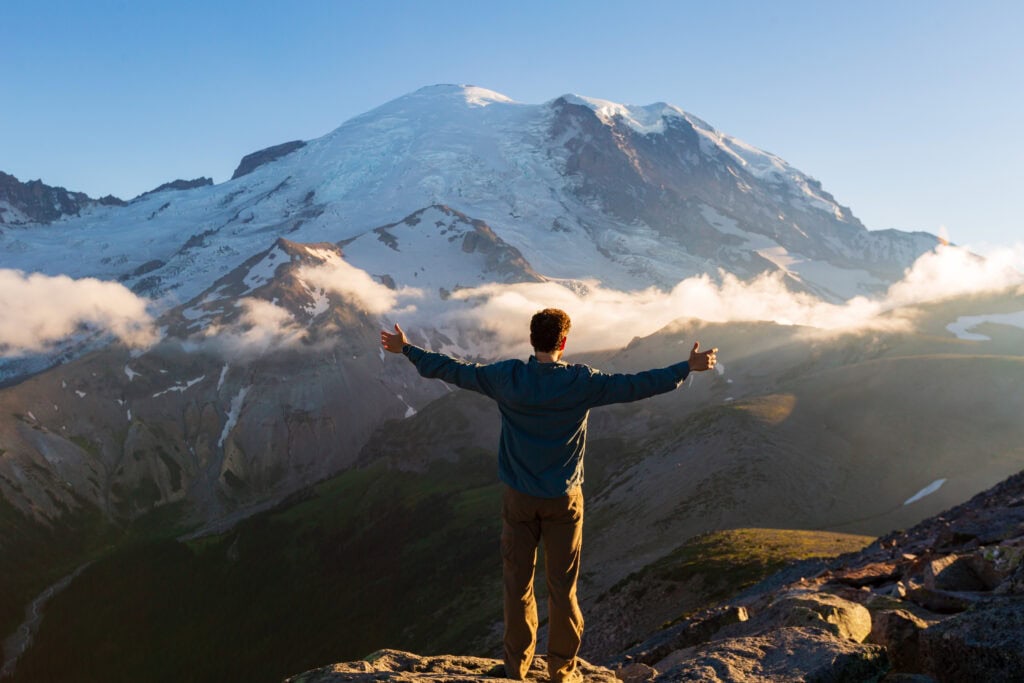
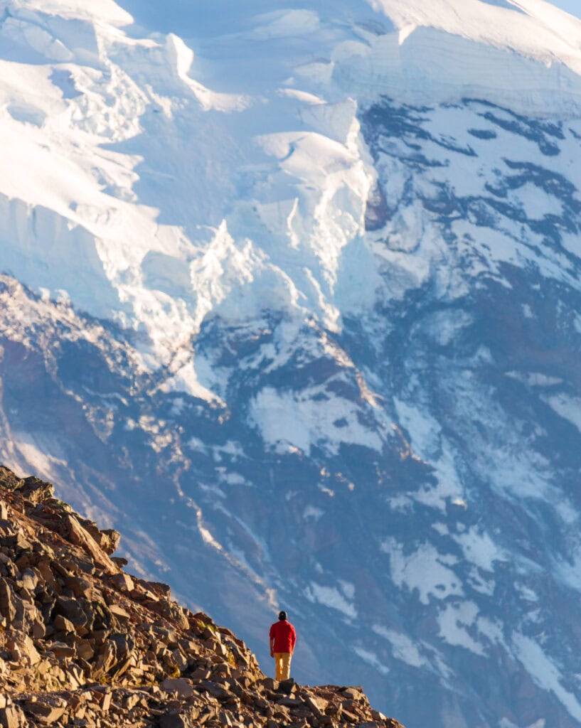
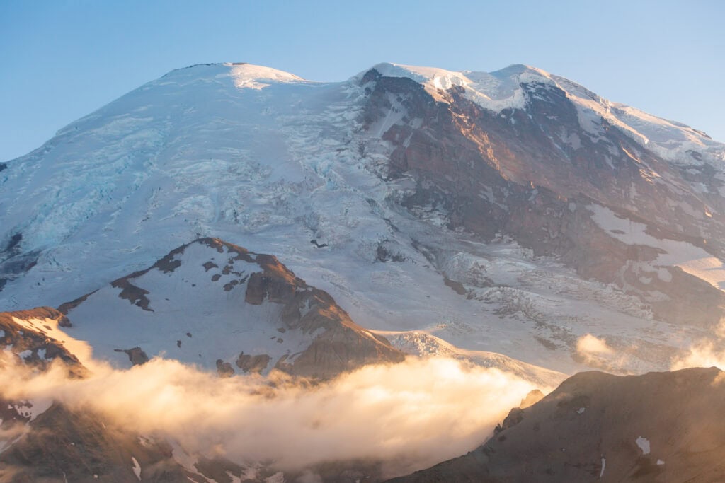
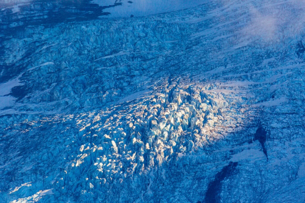
You get up close and personal to Rainer’s glaciers and ridgelines, but you are still far enough away to understand its massive scale. Plus, you get to see the lookout when you look north, which creates some spectacular photo opportunities with Mount Baker and Glacier Peak in the distance.
Keep reading for more information on this hike and to see my photos from my two trips here.
Easy Booking: Expedia.com | Hotels.com | VRBO | Booking.com
Need Gear: Find Gear at REI
Find Awesome Tours: Viator.com or GetYourGuide.com
See More Travel and Hiking Inspiration: @Alecoutside
Iceland on your bucket list? Get my Iceland guide + 144 pinned locations on Google Maps
Hiking Burroughs Mountain Trail in Mount Rainier National Park
Quick Hike Details
- Distance: 7-10 miles depending on turnaround point
- Elevation Gain: 2,500 feet or more
- Time on Trail: 4-6 hours
- Trailhead Location: Sunrise Visitor Center, Mount Rainier National Park
Trail Report for exploring the Burroughs Mountain Trail
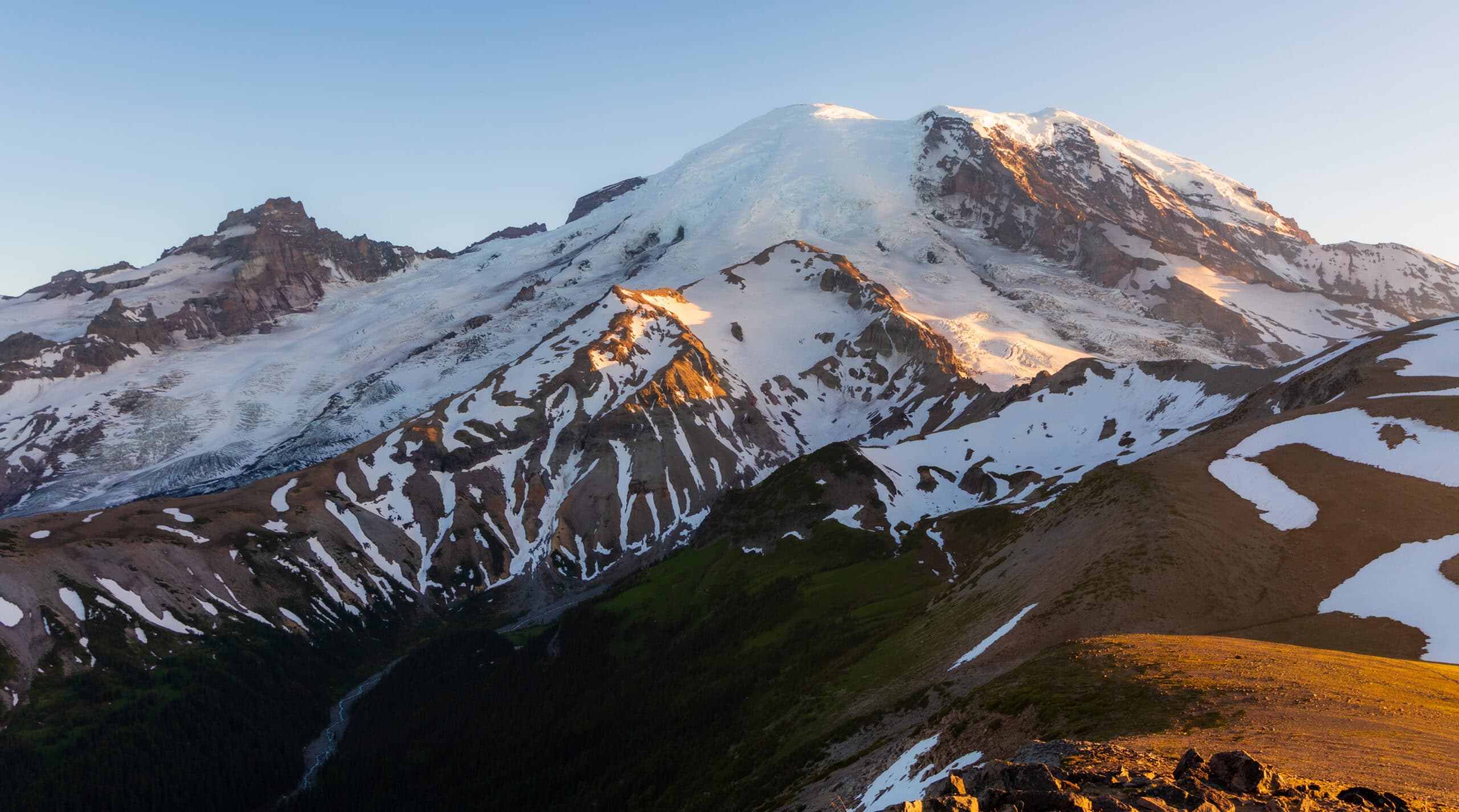
The Burroughs Mountain Trail is by far my favorite hike in the Sunrise Visitor Center region. Instead of hiking directly on Mount Rainier, like on the Paradise side, you are far enough away where you get some perspective of how large the volcano is, but also close enough to admire it.
I’ve done this hike twice, once in 2020 and another in 2023.
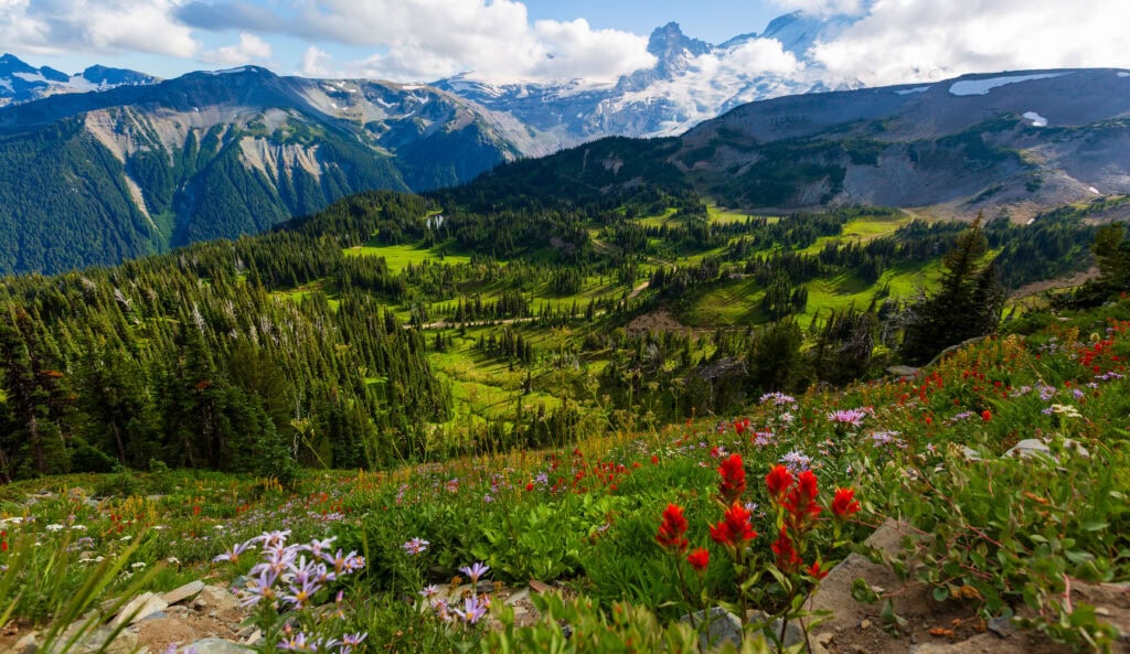
You’ll park in the big parking lot and hike up the standard trail (where you can also access Fremont Lookout and Dege Peak) before turning left. Once you reach this junction, turn around. You’ll have a lovely view of Mount Rainer, and in July, wildflowers should be all over!
From here, you’ll keep ascending a moderately inclined trail toward the mountain. This will be one of the most crowded sections of the trail as it narrows.
Once you reach the small pond, start hiking left and toward Mount Rainer. This section is also somewhat steep and rocky, but it’s not long. After 15 minutes, you’ll be on the top of the first Burrough and have exceptional views!
But don’t stop here.
Keep going to Second Burrough. You’ll lose even more tourists by hiking out here and having much better views.
This is where you might encounter some snow, depending on the time of year. Take your time, but it shouldn’t be too challenging. Hiking poles would definitely help.
Now, if it’s a clear day, don’t only look at Rainier. Look to the north, where you might be able to see Mount Baker near the Canadian border, as well as Glacier Peak. These are two of Washington’s five volcanos. (PS: if it’s a clear day, bring binoculars.)
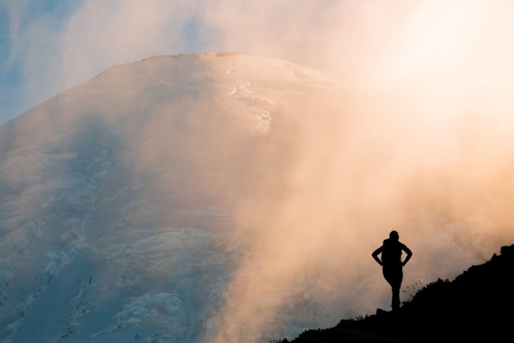
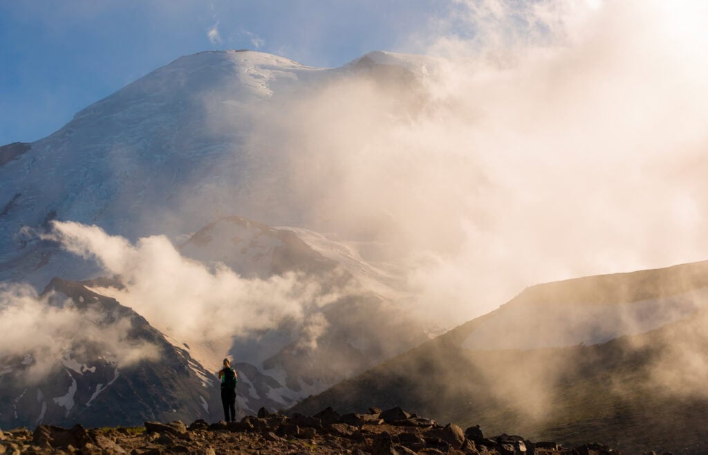
If you’re okay hiking back with a headlight, I recommend staying up for sunset. It’s a magical experience, and the odds are high that you’ll have the entire place to yourself.

What to know for Hiking Burroughs Mountain Trail
Where is it located?
The Burroughs Mountain Trail starts at the Sunrise Visitor Center on Mount Rainier’s northeast side. You’ll enter the park from the north and drive through the White River Entrance. From here, drive up the switchbacks, where you’ll start to gain incredible views of Mout Rainier and the surrounding peaks.
- Drive time from Seattle: 2.25 hours
- Drive time from Portland: 2 hours
- Drive time from Tacoma: 3.5- 4 hours
Tips for hiking the Burroughs Mountain Trail
- It’s far less visited than the nearby Fremont Lookout. Enjoy the solitude up there.
- There will likely still be snow on the trail on shaded, north-facing slopes. Take these slowly, but there’s not an inherent danger.
- I’ve never been, but people say Third Burroughs is incredible. This is the furthest one, meaning more distance and elevation gain. If you have the time, get out there. You’ll likely be alone.
- The trail does a sort of roller coaster on the way up. You’ll have an incline, then a flat part, then an incline, and so forth.
- Photographers, bring a long lens. Yes, it’ll make your pack heavier, but getting to photograph the layers looking north towards Mount Baker and Glacier Peak is surreal.

How Hard is the hike?
I’ve never found the trail to be too challenging, but you will be breathing hard, especially coming from sea level in Seattle. The Burroughs Mountain hike is the highest-elevation trail in that area. The first part of the trail is the same one you’ll take for Fremont Lookout, and then you’ll split at the reservoir.
This next section will have a decent elevation gain. But then it flattens out and even drops a bit.
Overall, the Burroughs Mountain Trail is a hard hike if you do all of it, but you won’t be dying on every step.
Are dogs allowed on the trail?
Dogs are not allowed on the trail at Burroughs Mountain or any substantial trail inside Mount Rainier National Park. Leave the pupper at home when visiting our national parks.
When is the best time of year for hiking to Burroughs Mountain?
If history serves us right, the park’s Burroughs Mountain Trail and Sunrise section don’t usually open until the end of June or the 4th of July weekend. It typically stays open until early/mid-October, which gives you 3.5 months to enjoy the beautiful hikes and views in the area.
But that quarter of the year is absolutely perfect and will provide you with everything you need to enjoy this stunning area of Mount Rainier National Park.
Will I have cell service?
Cell service will be spotty at best in this area. I wouldn’t go into the hike expecting to have any. If you feel safer using a communication device, I recommend a Garmin inReach 2. This will allow you to contact help if you get injured.
More Photos of Mount Rainer and Burroughs Mountain Trail


Staying Near Mount Rainer
The area around Mount Rainier National Park is pretty rural, so you won’t have any big, luxury areas, but there are a few places to key in on.
For the Burroughs Mountain hike, I’d focus on the Enumclaw or Crystal Mountain area (which has year-round lodging thanks to the ski resort). To the south, you’ll find Packwood and Ashford, but that’s not as ideal for making the drive for this hike.
Or you can camp! White River is the closest campground and is first come, first serve. If you can get here on Thursday, you’ll have a decent shot of landing a spot for the weekend.
Leave No Trace
Due to the Trump administration’s cuts, there are fewer National Park staff, making it even more important to be great stewards of our environment. Remember to pack out what you pack in, stay on designated trails as best you can, and be courteous to visitors and staff.
Another thing to note for this trail is to park only in designated parking areas. Do not park on the grass or slopes if there are no open spaces. Thankfully, with timed entry permits, this isn’t as big of a deal as it used to be.
Other things to consider:
- Bringing TP
- Hand sanitizer
- Expect longer traffic lines
FAQ: Mount Rainier’s Burroughs Mountain hike
Will there be timed entry permits in 2025?
That’s the great unknown right now. In 2024, Mt. Rainier implemented T.E.P. for the first time to reduce congestion during peak hours. But currently, with many things in flux with the National Park Service, no decision has been made as of 2.25.25.
You can learn more about what the 2024 permit system looked like here.
Are there bears in Mount Rainier?
Yes! There are bears in the park, but this is a pretty popular area that will have less bear visitation. If you want to see bears, heading out to Spray Park is a great place to see them. You do not need to carry bear spray in Mount Rainier National Park. You’ll only encounter black bears, and they will be much more afraid of you than you are of them.
If that makes you feel better, I’ve never seen a bear in the Burroughs/Sunrise area.
What gear to pack for your hike
- Wide-brimmed hat
- Sunglasses
- Sun shirt or sun hoodie
- Hiking Shoes or Trail Runners
- Hiking Shorts or Hiking Pants
- 25L+ Hiking Pack
- 2L hiking bladder or water bottles
- Garmin inReach 2
- Garmin Fenix hiking watch
- Light jacket for mornings
- Hiking Poles
Wrapping Up Your Burroughs Mountain Trail Guide
As you can see, this trail is simply stunning. The Burroughs Mountain Trail will give you everything you desire at Mount Rainier National Park. I hope you have an incredible time and are able to spend multiple days here to see both sides of the mountain and all it has to offer!
Until next time, adventurers, stay safe.
Follow on social media: TikTok || Instagram || Facebook || Newsletter | YouTube